
Download KLSeisII 3.2.1 – Advanced Geophysical Survey Software
KLSeisII is a specialized software application developed for the geophysical survey industry, designed to facilitate the planning, execution, and analysis of seismic data acquisition. This software is crucial for geophysical survey operations, enabling professionals to manage complex survey designs and interpret resulting data effectively. Its primary function is to support geophysicists and survey engineers in optimizing seismic surveys for superior data acquisition and analysis.
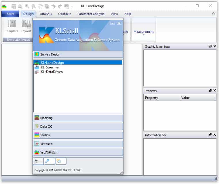
Introduction to KLSeisII
Overview of the Software’s Purpose
KLSeisII serves as essential seismic survey software for geophysical professionals. It is engineered to assist in the meticulous planning and execution of geophysical surveys, catering to a wide range of industry needs. The software provides robust tools for designing surveys and analyzing collected seismic data, aiming to improve overall data quality and provide detailed insights into subsurface geological structures. Its application is vital for organizations engaged in geophysical exploration and data interpretation.
Capabilities in Survey Design
The software excels in providing comprehensive tools for designing both 2D and 3D seismic surveys. These capabilities are fundamental for geophysicists aiming to map subterranean formations accurately. KLSeisII allows for detailed planning, ensuring that survey parameters are optimized for the specific geological challenges of a given area, thereby maximizing the potential for successful data acquisition and interpretation.
- Support for 2D and 3D survey design projects
- Tools to optimize survey geometry and parameterization
- Facilitation of efficient acquisition planning
Applications in Various Environments
KLSeisII demonstrates remarkable versatility by supporting operations across multiple environments. This adaptability makes it a valuable tool for diverse geophysical challenges encountered in the field. The software is capable of handling complex survey requirements in different settings, from onshore exploration to offshore operations.
- Land surveys: Designed for terrestrial geophysical data acquisition.
- Marine surveys: Optimized for offshore seismic data gathering.
- Transition Zone (TZ) operations: Facilitates surveys in coastal and near-shore areas where land and marine environments meet.
- Vertical Seismic Profiling (VSP) operations: Supports specialized well-based seismic surveys to understand subsurface geology directly.
Geological Modeling and Analysis Tools
Beyond survey design, KLSeisII offers powerful tools for the analysis and modeling of seismic data. These features are critical for assessing data integrity and interpreting geological structures. By employing these analytical capabilities, users can gain deeper insights into the subsurface, which is essential for informed decision-making in exploration and resource management.
- Bin analysis for data organization and review
- Seismic data quality analysis to ensure signal integrity and minimize noise
- Static corrections to account for near-surface variations and improve data accuracy
- Geological modeling for visualization and interpretation of subsurface structures
Integration and Compatibility
KLSeisII is designed to work within a broader geophysical workflow, enabling seamless integration with other industry-standard tools and systems. This compatibility ensures that data can flow efficiently between different stages of exploration and analysis, from acquisition to final interpretation. The software’s design philosophy emphasizes interoperability within the complex ecosystem of geophysical software and hardware.
- Interoperability with common data formats used in geophysics
- Potential to interface with seismic acquisition hardware and processing systems
- Facilitates a cohesive data management strategy across survey operations
Real-World Use Cases
In practical field operations, KLSeisII is applied to a variety of projects requiring detailed subsurface investigation. Its capabilities are instrumental in optimizing resource exploration, environmental assessments, and geological hazard analysis. By leveraging KLSeisII, companies can enhance the efficiency and accuracy of their geophysical survey operations, leading to better project outcomes.
- Planning and execution of seismic surveys for oil and gas exploration
- Environmental impact studies requiring detailed subsurface mapping
- Geotechnical investigations for infrastructure projects
- Resource assessment and management for mining operations
Frequently Asked Questions
What types of surveys can I design with KLSeisII?
KLSeisII supports the design of both 2D and 3D surveys for various applications, including land, marine, transition zone (TZ), and vertical seismic profiling (VSP) operations. This comprehensive support allows users to adapt the software for diverse geophysical surveying scenarios.
How does KLSeisII improve seismic data quality?
The software incorporates advanced seismic data quality analysis tools to assess and enhance data integrity, ensuring accurate results for geophysical surveys. By identifying and addressing potential issues, KLSeisII helps to achieve cleaner, more reliable seismic data.
Can KLSeisII handle geological modeling?
Yes, KLSeisII includes features for geological modeling, which allows users to create detailed representations of subsurface geological structures essential for effective survey planning. This capability aids in understanding the subsurface complexity and optimizing data acquisition strategies.


Reviews
There are no reviews yet.