
Download MicroSurvey STAR*NET – Advanced Survey Adjustment Software
MicroSurvey STAR*NET is a specialized surveying software developed by MicroSurvey Software Inc., designed for professionals in surveying and geospatial engineering. This application is pivotal for accurately adjusting complex 2D and 3D survey networks, integrating various types of observational data using advanced mathematical methods. Its primary function is to ensure the highest level of precision in geospatial project calculations.
Introduction to MicroSurvey STAR*NET
Overview and Importance in Surveying
MicroSurvey STAR*NET serves as a critical tool for surveyors and geospatial engineers, providing a robust platform for the rigorous adjustment of survey networks. In an industry where precision is paramount, the software leverages advanced statistical techniques to reconcile discrepancies in measured data. Its importance lies in its ability to transform potentially inaccurate field measurements into reliable, high-accuracy geodetic control, which is fundamental for land surveying, construction, and other geospatial applications.
Analyzing Survey Networks
Understanding Least Squares Adjustment
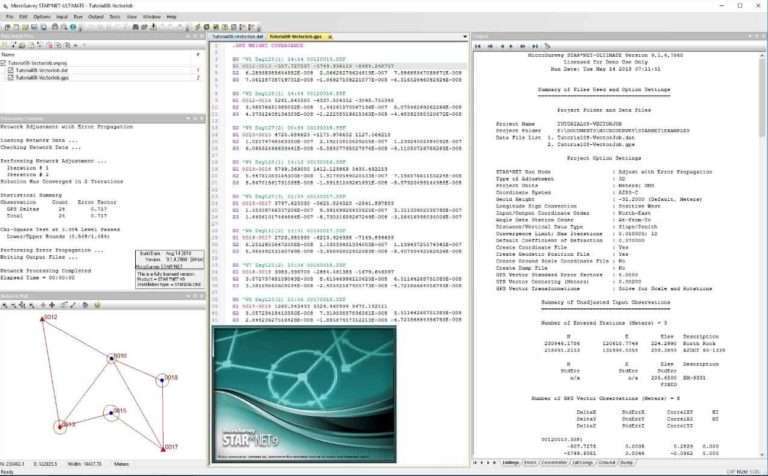
At the core of MicroSurvey STAR*NET’s functionality is the Least Squares adjustment technique. This statistical method is used to find the most probable values for unknown quantities in a complex system by minimizing the sum of the squares of the differences between observed and computed values. In surveying, this means STAR*NET can process a large volume of diverse measurements—such as angles, distances, and GPS vectors—and mathematically determine the most accurate positions for survey points, accounting for measurement errors.
Key Features of STAR*NET
Supported Observational Methods
MicroSurvey STAR*NET offers comprehensive support for a wide array of observational data types essential for modern surveying projects:
- Conventional Measurements: It processes traditional surveying observations including total station data, theodolite angles, and differential leveling readings.
- GPS and GNSS Data: The software seamlessly integrates GPS vectors, post-processed kinematic (PPK) data, and other Global Navigation Satellite System (GNSS) measurements, allowing for a unified adjustment of mixed-data networks.
- Combined Network Adjustments: STAR*NET’s capability to concurrently process and adjust these disparate sources of data is a significant advantage, providing a more robust and accurate representation of the surveyed area.
Real-World Applications
Use Cases in Different Surveying Scenarios
MicroSurvey STAR*NET is a versatile tool applied across various demanding geospatial engineering and surveying projects:
- Large-Scale Infrastructure Projects: For the precise control establishment required in major civil engineering undertakings like bridge construction or highway development, STAR*NET ensures the integrity of the foundational survey network.
- Land Boundary and Cadastral Surveys: It is used to resolve complex boundary definitions and re-establish property lines where multiple previous surveys might conflict, ensuring legal accuracy.
- Collaborative Surveying Environments: On large construction sites or in extensive land development projects, STAR*NET facilitates the integration of data from multiple survey crews and instruments, enabling a unified and error-checked dataset.
- Geodetic Control Densification: Projects requiring the establishment or densification of local, regional, or national geodetic control networks benefit from STAR*NET’s capacity to precisely position new control points based on existing benchmarks.
Compatibility and Integration
Working with Other Software
MicroSurvey STAR*NET is designed to integrate smoothly into existing geospatial workflows. It supports various industry-standard data formats, allowing for efficient import of raw field data from popular data collectors and export of adjusted coordinates and reports to other CAD and GIS platforms. This ensures that the precise results generated by STAR*NET can be readily utilized in downstream design, analysis, and mapping software, making it a valuable component in a comprehensive geospatial engineering toolkit.
Frequently Asked Questions
What is MicroSurvey STAR*NET used for?
MicroSurvey STAR*NET is a software application designed for adjusting 2D and 3D survey networks utilizing advanced Least Squares techniques. It facilitates precise integration of various observations including conventional and GPS measurements, ensuring high accuracy for geospatial projects.
How does STAR*NET handle GPS data in surveys?
STAR*NET allows users to incorporate GPS vectors into their survey networks, enabling comprehensive adjustments that blend traditional measurements with modern geospatial data. This capability enhances accuracy and efficiency in survey processing by treating GPS data alongside other observational types.
Can STAR*NET be used for large survey networks?
Yes, STAR*NET can handle up to 10,000 adjustable stations simultaneously, making it suitable for both small and complex survey networks. Its robust capabilities are designed to meet the needs of extensive surveying projects requiring high precision and significant data management.


Reviews
There are no reviews yet.