
Download ESurvey CADD 14.70 – Comprehensive Software for Civil Survey Engineers
ESurvey CADD 14.70 is a specialized civil engineering software designed to enhance the efficiency and accuracy of surveying tasks. Developed to assist civil survey engineers and professionals in the construction industry, it focuses on streamlining complex processes such as contour generation, earthwork calculations, and data integration within a CAD environment. This application aims to significantly reduce the time and effort required for traditional surveying computations, making it a valuable tool for modern engineering projects.
Introduction to ESurvey CADD
Overview of ESurvey CADD’s Functionality
ESurvey CtextSize is a robust software application tailored for the civil engineering and construction sectors. It provides a suite of tools engineered to automate and simplify critical surveying computations. By integrating advanced CAD capabilities with specialized functions for terrain modeling and earthwork, ESurvey CADD empowers users to manage project data more effectively and achieve higher levels of precision in their work. The software is particularly beneficial for tasks involving large datasets and complex geographical information typical in civil survey engineering.
Key Tools and Capabilities
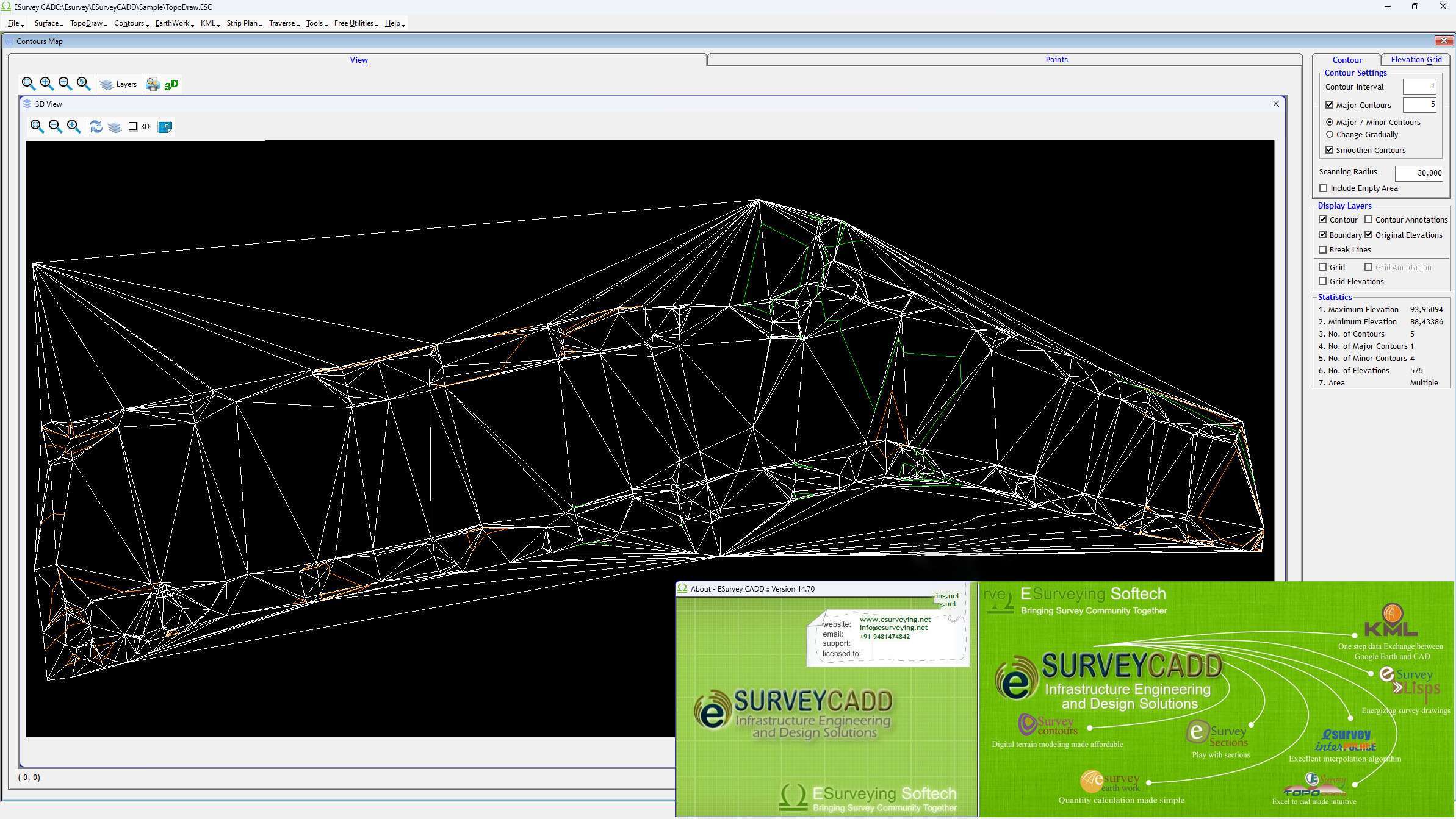
Topodraw: Advanced Data Import and Management
Topodraw is a core component within ESurvey CADD, facilitating the seamless import and management of raw survey data. It supports various data formats, allowing engineers to easily integrate information from different sources into their projects. This capability ensures that data integrity is maintained throughout the process, from initial field collection to final analysis within the CAD environment.
- Import data from formats such as CSV, Excel, and standard survey data loggers.
- Organize and manage survey points, lines, and other geometric entities efficiently.
- Prepare raw data for subsequent analysis and visualization within ESurvey CADD.
Contour Generation: Creating Accurate Terrain Models
The contour generation feature in ESurvey CADD is designed to automatically create accurate topographical maps from imported survey data. This automation significantly speeds up the process of terrain modeling, which is essential for site planning, design, and earthwork assessments. The software’s ability to generate precise contours aids in visualizing the landscape and understanding topographical variations.
- Automated generation of contour lines based on imported survey point data.
- Customizable contour intervals and labeling for clear visualization.
- Tools for refining contour accuracy and ensuring topographical correctness.
Earthwork Calculations: Simplifying Complex Analyses
ESurvey CADD streamlines the complex process of earthwork calculations, a critical aspect of construction and infrastructure projects. The software provides tools for calculating volumes of cut and fill, generating detailed reports, and assisting in quantity takeoffs. This capability helps engineers estimate material requirements and manage project costs more effectively.
- Accurate calculation of earthwork volumes from terrain models.
- Generation of interim and final reports detailing cut and fill quantities.
- Support for various methods of volume calculation to suit project needs.
Industry Applications and Use Cases
ESurvey CADD is deployed across a variety of civil engineering and construction projects to enhance operational efficiency and data accuracy. Its features are instrumental in tasks ranging from initial site surveys to the final stages of project assessment. For instance, in road construction projects, the software’s earthwork calculation capabilities help in precise material estimation and grading plans. Similarly, for land development and infrastructure planning, its contour generation tools provide essential topographical data for effective design and execution. These applications demonstrate how ESurvey CADD contributes to improved time management and cost-effectiveness in real-world engineering scenarios.
Comparison with Other Civil Software Solutions
Compared to other general CAD applications, ESurvey CADD distinguishes itself through its specialized toolset focused on civil survey engineering workflows. While many CAD programs offer drawing and design capabilities, ESurvey CADD provides integrated features for automated contour generation and detailed earthwork calculations that are often handled by separate, more specialized modules or require manual processing in other software. Its strength lies in combining these essential surveying computations directly within a familiar CAD environment, offering a more streamlined and efficient solution for professionals in this specific field.
Benefits of Using ESurvey CADD for Civil Engineers
Employing ESurvey CADD offers several distinct advantages for civil engineers and surveyors. The software’s automated processes lead to significant improvements in project timelines and a reduction in manual labor. Key benefits include:
- Enhanced Efficiency: Automation of repetitive tasks such as data import, contour drawing, and volume calculations saves considerable time.
- Improved Accuracy: Precise calculations and automated modeling reduce the risk of human error inherent in manual surveying computations.
- Cost-Effectiveness: By optimizing workflows and reducing the need for extensive manual work, the software contributes to overall project cost savings.
- Streamlined Data Management: Integrated tools for data import and organization ensure all project information is accessible and manageable within a single platform.
Conclusion and Getting Started with ESurvey CADD
ESurvey CADD 14.70 stands as a powerful and dedicated solution for civil survey engineers seeking to optimize their design and calculation processes. Its specialized features for contour generation, earthwork analysis, and data management, combined with its CAD integration, offer substantial benefits in terms of efficiency and accuracy. For professionals looking to enhance their surveying capabilities and improve project outcomes, downloading ESurvey CADD provides access to a tool that directly addresses the core challenges in civil engineering fieldwork and analysis.
Frequently Asked Questions
What is ESurvey CADD used for?
ESurvey CADD is a software solution designed for civil survey engineers, primarily to create accurate contours, generate section drawings, and calculate earthwork quantities efficiently. It automates many of the time-consuming tasks associated with field data processing and analysis in civil engineering projects.
How does ESurvey CADD facilitate contour generation?
The software allows users to import data from various formats such as CSV and Excel to generate contours directly within the CAD environment, streamlining the surveying process. This feature enables the rapid creation of accurate topographical models essential for planning and design.
Can ESurvey CADD be used for earthwork calculations?
Yes, ESurvey CADD includes functionalities for generating detailed earthwork calculations, providing interim reports and quantitative analyses crucial for construction projects. This capability assists in estimating material requirements and managing project budgets effectively.


Reviews
There are no reviews yet.