
Download PCI Geomatica Banff 2020 – Advanced Remote Sensing Software
PCI Geomatica Banff 2020 is an advanced suite of geospatial analysis software developed by PCI Geomatics, specifically designed for processing and analyzing Earth observation data. This comprehensive package is a critical tool for professionals and researchers in remote sensing, environmental science, and geospatial analysis, enabling detailed examination of satellite and aerial imagery for diverse applications.
Introduction to PCI Geomatica Banff 2020
PCI Geomatica Banff 2020 represents a significant advancement in the field of remote sensing and photogrammetry, offering robust capabilities for managing, processing, and analyzing geospatial data. Developed by PCI Geomatics, this software is instrumental for extracting valuable information from satellite and aerial imagery, supporting applications across environmental monitoring, resource management, and scientific research. Its widespread adoption in educational institutions underscores its importance in training the next generation of geospatial professionals.
Core Capabilities of PCI Geomatica
Advanced Image Processing
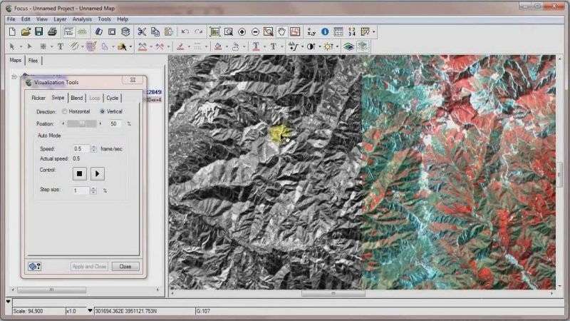
At its core, PCI Geomatica excels in providing a comprehensive toolkit for advanced image processing. This includes sophisticated algorithms for image enhancement, classification, change detection, and feature extraction, all designed to derive meaningful insights from complex remote sensing data. Professionals utilize these tools for detailed analysis of land cover, urban development, and environmental changes.
Key image processing functions include:
- Radiometric and geometric correction
- Image mosaicking and ortho-rectification
- Supervised and unsupervised image classification
- Change detection analysis techniques
- Detailed feature extraction and mapping
Support for Diverse Data Formats
A significant advantage of PCI Geomatica is its extensive support for a wide array of data formats and sensors from various satellite and aerial platforms. This versatility ensures interoperability and allows users to work with data from sources such as ADS, PALSAR, and TripleSat, among many others. This broad compatibility is essential for integrating diverse datasets into a unified analytical workflow.
The software accommodates numerous sensor types and data formats, including:
- Various satellite sensor data (e.g., Landsat, Sentinel, SPOT)
- Aerial photography formats
- LiDAR data
- Radar imagery (SAR)
- Georeferenced raster and vector data
Applications in Education and Research
PCI Geomatica is a vital tool in academic settings worldwide. Over 2,700 educational institutions leverage its capabilities for teaching remote sensing principles and conducting advanced research. Universities utilize it to equip students with practical skills in analyzing geospatial data, preparing them for careers in environmental science, urban planning, and Earth observation fields.
Specific applications in education and research include:
- Remote sensing course modules and practical labs
- Masters and PhD research projects in Earth sciences
- Development of new analytical methodologies
- Training on industry-standard geospatial software
- Analyzing environmental impacts and natural resource changes
Comparative Analysis with Other Remote Sensing Software
When compared with other leading remote sensing software such as Erdas Imagine and ENVI, PCI Geomatica maintains a strong position due to its comprehensive feature set and commitment to open standards. While Erdas Imagine is known for its deep integration with other geospatial platforms, and ENVI offers advanced spectral analysis capabilities, PCI Geomatica differentiates itself through its robust processing speeds, extensive sensor support, and strong adherence to OGC standards for seamless data sharing.
Key comparison points include:
- Processing speed and efficiency
- Breadth of sensor and data format compatibility
- Integration capabilities with other software
- Advanced analytical tools for specific domains
Real-World Use Cases
In practice, PCI Geomatica is employed across numerous critical applications. Environmental agencies use it for monitoring deforestation, tracking urban sprawl, and assessing the impact of climate change. Resource management companies rely on it for detailed land cover classification, mineral exploration, and agricultural monitoring. Its utility extends to disaster management, aiding in the assessment of damage after floods, fires, and other natural events.
Practical scenarios include:
- Mapping and monitoring of forest resources
- Urban planning and infrastructure development analysis
- Precision agriculture for crop health assessment
- Water body monitoring and management
- Geological surveys and mineral exploration
Standards Compliance and Data Sharing
PCI Geomatica’s compliance with Open Geospatial Consortium (OGC) standards, particularly through its web coverage service interface, significantly enhances its value. This adherence to open standards ensures interoperability, allowing data processed and managed within PCI Geomatica to be easily shared and integrated with other geospatial platforms and services. This facilitates collaborative research and promotes broader access to geospatial information.
Benefits of standards compliance include:
- Seamless data exchange with other OGC-compliant systems
- Support for web services for data access and dissemination
- Enhanced interoperability in distributed geospatial environments
- Facilitation of collaborative analysis and data management
Frequently Asked Questions
What is PCI Geomatica Banff 2020 used for?
PCI Geomatica Banff 2020 is used for processing and analyzing remote sensing data from satellite and aerial imagery. It is primarily utilized in environmental science and geospatial analysis across various industries and academic settings for tasks like land cover classification, change detection, and feature extraction.
How does PCI Geomatica compare to other remote sensing software?
PCI Geomatica is comparable to software like Erdas Imagine and ENVI, particularly in its image processing capabilities and support for multiple data formats. Each software has unique strengths, making the choice dependent on specific user needs and workflows, with PCI Geomatica often noted for its processing speed and OGC compliance.
What academic institutions utilize PCI Geomatica?
Over 2,700 educational institutions worldwide, including institutions like the University of Calgary and York University, use PCI Geomatica for remote sensing education, enabling students to gain practical experience with advanced geospatial tools and methodologies.


Reviews
There are no reviews yet.