
Download CSoft PlanTracer Techplan Pro 8.0 – Professional Cadastral Engineering Software
CSoft PlanTracer Techplan Pro 8.0 is a specialized cadastral software developed by CSoft, designed for professionals in cadastral engineering and land management. This technical planning software enables users to efficiently generate and manage the documentation required for official land surveying and registration processes, with a particular focus on compliance with Russian cadastral regulations. The software aims to streamline workflows for land management professionals, assisting them in creating accurate technical plans and integrating with key governmental information systems.
Overview of CSoft PlanTracer Techplan Pro 8.0
Introduction to Cadastral Software
Cadastral software plays a critical role in modern land management by digitizing and streamlining the complex processes involved in surveying, mapping, and registering land parcels. This software enables cadastral engineers to accurately document property boundaries, ownership details, and land use information in standardized formats. Its importance lies in ensuring legal compliance, facilitating property transactions, and supporting urban planning and resource management initiatives. Effective cadastral software supports the generation of essential technical plans and integrates with governmental databases for official record-keeping.
Key Features for Cadastral Engineers
Technical Plan Generation
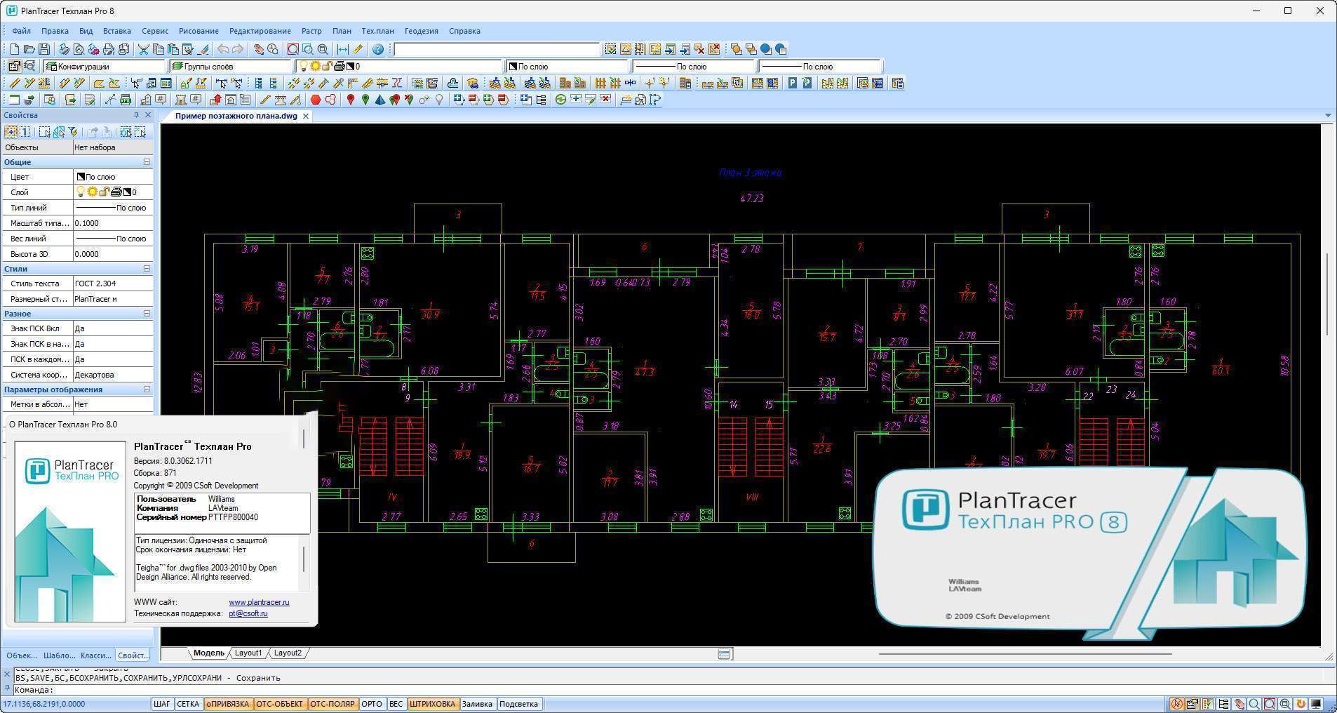
CSoft PlanTracer Techplan Pro 8.0 offers robust capabilities for generating detailed technical plans. Users can create documentation in a variety of formats required for official submissions, ensuring that all necessary graphical and textual information is accurately represented. This feature is central to the software’s utility for cadastral engineers dealing with land parcel registration and boundary demarcation.
Integration with AIS State Control
A significant advantage of this cadastral software is its integration with Governmental Information Systems, such as the AIS State Control Committee. The software supports the automated generation of document packages, including the crucial electronic signature, which is essential for submitting digital documents for state control and registration purposes. This integration streamlines the submission process and enhances compliance with electronic reporting requirements.
Graphic Editing Tools
The software is equipped with comprehensive graphic editing tools that are vital for cadastral engineers. These tools facilitate detailed work with floor plans, technical drawings, and scanned images. Professionals can manipulate graphical data to precise specifications, ensuring accuracy when incorporating survey data or revising existing land parcel representations within their projects.
Industry Applications
Use Cases in Land Management
CSoft PlanTracer Techplan Pro 8.0 is extensively used in various land management scenarios. Cadastral engineers utilize it for tasks such as creating land surveying plans, defining property boundaries, and preparing technical descriptions for real estate. The software supports professionals in managing land resources efficiently and accurately, which is fundamental to urban development and environmental management.
Compliance with Rosreestr Requirements
Adherence to regulatory standards is paramount in cadastral engineering. This land management software is specifically designed to help users meet the stringent requirements set by Rosreestr (the Russian Federal Service for State Registration, Cadastre and Cartography). By generating compliant technical plans and integrating with relevant state systems, PlanTracer Techplan Pro 8.0 assists professionals in navigating complex legal frameworks and ensuring their submissions are accepted by regulatory authorities.
Real-World Projects Utilizing PlanTracer
Professionals in cadastral engineering have leveraged CSoft PlanTracer Techplan Pro 8.0 in numerous projects demanding precise documentation and regulatory compliance. For instance, it has been instrumental in projects involving the subdivision of large land plots, the formalization of existing property boundaries in areas undergoing development, and the preparation of documentation for new construction sites. The software’s ability to handle complex datasets and integrate with systems like AIS State Control ensures that these projects move forward efficiently, meeting all legal and technical specifications required for official registration and public record.
Comparison with Similar Tools
Compared to general-purpose CAD software, CSoft PlanTracer Techplan Pro 8.0 offers specialized features tailored for cadastral engineering. While other tools may provide broad design capabilities, PlanTracer excels in automating the generation of legally compliant technical plans and integrating directly with governmental submission platforms like the AIS State Control Committee. This focus on specialized document creation and regulatory compliance distinguishes it within the competitive landscape of land management software.
User Testimonials and Feedback
Users of CSoft PlanTracer Techplan Pro 8.0 often highlight its efficiency in complex cadastral tasks. Many professionals appreciate the software’s dedicated tools for generating the specific documentation required by Russian land regulations, noting that it significantly reduces the time spent on manual drafting and formatting. The integration with electronic signature capabilities and governmental databases is frequently cited as a key benefit, streamlining submission processes and minimizing errors in official land records.
Frequently Asked Questions
What is CSoft PlanTracer Techplan Pro 8.0 used for?
CSoft PlanTracer Techplan Pro 8.0 is primarily used for creating technical plans for cadastral engineering, allowing for document generation in both electronic and print formats. It serves professionals in land management and construction who need to produce official documentation for land registration and surveying purposes.
How does CSoft PlanTracer integrate with governmental systems?
The software supports automatic package generation with an electronic signature for submission to the AIS State Control Committee, enhancing compliance with state regulations. This feature simplifies the process of submitting digital documents to governmental bodies for approval and record-keeping.
What graphic editing tools does CSoft PlanTracer include?
CSoft PlanTracer includes comprehensive graphic editing tools for working with both technical and floor plans as well as scanned images, essential for detailed cadastral projects. These tools allow for precise manipulation and annotation of graphical data necessary for accurate land documentation.


Reviews
There are no reviews yet.