
Trimble Novapoint 2026.2: Comprehensive Infrastructure BIM Design Software
Trimble Novapoint 2026.2 is a comprehensive infrastructure BIM solution that enables civil engineers to efficiently design all aspects of modern roads, railways, tunnels, bridges, water and sewer networks . Novapoint is part of Trimble’s extensive BIM ecosystem, combining a powerful multi-discipline modeling toolset with Quadri, a seamlessly integrated, cloud-based BIM collaboration server . This unique combination provides exceptional project teamwork, real-time data synchronization, and complete model lifecycle management .
Version 2026.2 introduces enhanced 3D solid generation for DWG export, improved cross-section viewing, expanded support for IFC 4.3-based object catalogs (Beta), market-specific updates for Denmark and Finland, and new quantity reporting features for cut volumes . Novapoint runs on top of Autodesk AutoCAD, Map 3D, or Civil 3D (versions 2021-2026) , allowing engineers to leverage familiar CAD environments while accessing specialized infrastructure design tools .
???? Primary Users
This professional infrastructure BIM software is designed for:
-
Civil Engineers & Infrastructure Designers designing roads, highways, railways, tunnels, and bridges.
-
BIM Coordinators & Project Managers managing multi-discipline infrastructure projects using cloud-based collaboration.
-
Geotechnical & Environmental Engineers analyzing terrain, subsurface layers, and drainage systems .
-
Construction & Surveying Professionals generating quantities, stakeout data, and construction documentation.
-
Urban & Landscape Planners designing side areas, landscaping, and streetscapes.
⚡ Key Features & Capabilities
????️ Road & Highway Design
Road Design Tools:
-
Parametric road modeling with alignments, profiles, and cross-sections
-
Junction and intersection design
-
Superelevation and widening based on national standards (Road Professional version)
-
Cut and fill volume calculations with mass reports
Terrain & Subsurface Modeling:
-
3D terrain surfaces from survey data and point clouds
-
Subsurface layer modeling (soil strata, rock surfaces)
-
Integration with geotechnical data via Quadri
???? Railways, Tunnels & Bridges
Railway Design (Add-on module):
-
Design regular rail, high-speed rail, metro, light rail, and tramways
-
Track geometry with cant (superelevation)
-
Switch and crossing design
-
Inframodel export support for Finland (IM4.0.4, IM4.2.0)
Tunnel Design:
-
Seamless connection with road/rail projects – tunnel model automatically updates when road/rail changes
-
Import scanner data for 3D visualization; compare with designed surface
Bridge Design:
-
Design bridges as part of the road alignment
-
Model structures, add road lines, generate 3D models, cross-sections, and structural calculations
???? Water & Sewer, Drainage, Landscaping
Water & Sewer Design:
-
Pipe network modeling for water supply and sewage systems
-
Manhole and structure placement
-
Longitudinal profiles and sections
Landscaping & Side Areas:
-
Side area and landscaping design
-
Road signs and road markings (3D geometry generation)
-
Vegetation and street furniture placement
☁️ Quadri BIM Collaboration (Cloud-Based)
Real-Time Multi-Discipline Collaboration:
-
Architects, engineers, and contractors work on a unified 3D model
-
Simultaneous access; changes are visible instantly to all team members
-
Eliminates file‑based data exchange and reduces version conflicts
IFC 4.3 & Open BIM:
-
IFC 4.3 support (Beta) for infrastructure object types (road, rail, etc.)
-
Import/Export IFC, LandXML, Open DWG/DGN
-
Quadri Connectors for Revit, Civil 3D, Tekla, Open Roads Designer, Grasshopper, Trimble Connect, and more
Quadri for Windows (QfW) Enhancements in 2026.2:
-
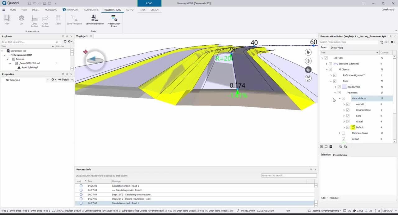
View in Cross Section – Right-click on Road/Railway/Trench tasks to preview cross-sections along alignment
-
Publish Solids to DWG – Single-shell solids automatically produce 3D Solids when publishing to DWG
-
Expanded Project Ownership Support – QfW now works with any activated Shared Object Model regardless of license tier
???? Quantity Reporting & Documentation
Model-Based Quantities:
-
Automatic extraction of volumes, areas, and lengths
-
New CUT features report – separates volumes by soil layer (Soil 1, Soil 2, Forest top soil, etc.) with intervals
-
Mass haul diagrams and cut/fill optimization
-
Quantity reports for tendering and construction
Trimble Drawing Integration:
-
Novapoint 2026 uses Trimble Drawing 2026 v.3513 for optimized CAD workflows
-
Direct production of plans, profiles, and cross-sections from the Quadri model
???? Import/Export & Interoperability
Import Formats:
-
LandXML, IFC, Open DWG/DGN, Scanner point cloud data
-
Quadri models directly
Export Formats:
-
IFC 4.3 (Beta – with spatial breakdown structure)
-
LandXML, DWG, DGN
-
Quantity reports (Excel, text), stakeout data
???? What’s New in Version 2026.2
-
Solids in Quadri – Stored as single shell → automatic 3D solids when publishing to DWG (Road, Railway, WS)
-
View in Cross Section – Right‑click preview of cross‑section views along alignment in Quadri for Windows
-
Expanded Quadri Access – QfW now works with all activated Shared Object Models regardless of owner’s license tier; access determined by signed‑in user’s license
-
IFC 4.3 Object Catalogue – Beta support; spatial breakdown structure definable for Road design tasks
-
New CUT Volume Report – Lists volumes by soil layer (Soil 1, Soil 2, Forest top soil) with intervals
-
3D Road Signs – Option to generate reflective film and sign face geometry as 3D surfaces
-
Market‑Specific Updates:
-
Denmark: Updated vehicle selection to match ‘Håndbog – Grundlag for udformning af trafikarealer’
-
Finland: Inframodel support (IM4.0.4/IM4.2.0), harmonized naming of binder course (“Sidekerros”)
-
-
Alignment as Surface Edge Fixes – Improved calculation speed and fixed left‑hand side issues
-
Railway – Cant values correctly handled for IFC 4.3 result objects; switch geometry fixes
-
Novapoint Landscape – Crash fix in Civil 3D environment
-
Quadri for Windows – Fixed color assignments in conversion rules; fixed CSV-loop handling of enumeration values


Reviews
There are no reviews yet.