
Download 3Dsurvey 4.1 – Advanced Photogrammetry Software for Surveying
3Dsurvey 4.1 is a specialized photogrammetry software developed by 3Dsurvey, designed for professionals in surveying, Geographical Information Systems (GIS), and construction engineering. It enables users to process imagery from various sources, including unmanned aerial vehicles (UAVs), to generate high-accuracy topographical maps and 3D models. This makes it an essential tool for efficient data acquisition and analysis in demanding fields like civil engineering and construction.
Overview of 3Dsurvey and Its Applications
3Dsurvey is a powerful photogrammetry software solution purpose-built for precise 3D surveying and mapping. Its significance lies in its ability to transform 2D photographs into detailed, georeferenced 3D models and topographic maps with remarkable accuracy. Professional surveyors and engineers leverage 3Dsurvey for a wide array of applications, including detailed site analysis in construction projects, optimizing land use in urban planning, and monitoring crop health in precision agriculture. The software is instrumental in providing a comprehensive digital representation of the terrain and existing structures.
How 3Dsurvey Works: Image Processing Technology
The core of 3Dsurvey’s functionality lies in its advanced image processing engine. This technology allows users to input a series of overlapping images, typically captured from UAVs or other aerial platforms. The software employs sophisticated algorithms to identify common points across these images, calculate their precise intersection points in 3D space, and then stitch these points together to construct a dense point cloud. This process, fundamental to photogrammetry, forms the basis for generating seamless, high-resolution 3D models and accurate orthophotos.
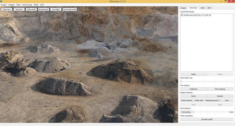
Key Features of 3Dsurvey 4.1
3Dsurvey 4.1 offers a suite of features tailored to streamline the photogrammetry workflow and enhance user experience:
- UAV Integration: Designed for intuitive use with UAVs, simplifying the process of aerial data capture for surveying tasks.
- Flight Log Independence: The software can process images effectively without requiring flight log files, offering greater flexibility in data acquisition planning.
- Area and Volume Calculation: Facilitates quick and accurate measurement of surface areas and material volumes directly from the generated 3D models.
- Continuous Development: The 3Dsurvey development team consistently enhances the software’s machine vision capabilities and image processing algorithms, ensuring ongoing improvements in accuracy and performance based on emerging technologies and user feedback.
Integration with UAVs and Other Equipment
3Dsurvey has been optimized for compatibility with a range of aerial data acquisition platforms, notably UAVs and remote-controlled helicopters. This integration allows for efficient and systematic data capture over large or complex sites. While the software can process images from various digital cameras, including those mounted on models like GoPro, its synergy with UAVs significantly accelerates the surveying and mapping process. This enables professionals to cover extensive ground quickly and collect high-resolution imagery essential for detailed 3D reconstruction.
Real-world Applications of 3Dsurvey
The practical utility of 3Dsurvey is evident in numerous professional project scenarios. In construction engineering, it is employed for detailed site surveys, progress monitoring, and verifying earthwork volumes. Civil engineers utilize it for creating accurate topographic maps of terrain for infrastructure planning and design. Furthermore, its capabilities extend to agriculture for precision farming applications, such as crop health assessment and field mapping, and to urban planning for generating detailed models of cityscapes for analysis and development.
Comparative Analysis with Other Surveying Software
Compared to general-purpose photogrammetry tools, 3Dsurvey distinguishes itself through its specialized focus on surveying and engineering workflows. While other software might offer broader functionalities, 3Dsurvey provides streamlined processes specifically for topographic mapping and volumetric calculations, often with a simpler user interface for these core tasks. Its efficient handling of UAV data, even without flight logs, and continuous improvements in its core photogrammetry algorithms offer distinct advantages for professionals prioritizing speed and accuracy in site analysis and measurement.
Conclusion and Future Developments
3Dsurvey 4.1 stands as a robust and efficient photogrammetry software solution for surveying and mapping professionals. Its advanced image processing, user-friendly features, and strong integration with UAV technology provide significant practical benefits for a variety of industries. As the development team continues to refine algorithms and incorporate user feedback, future versions are poised to further enhance accuracy, expand compatibility, and solidify its position as a valuable tool in the geospatial technology landscape.
Frequently Asked Questions
What types of images can I use with 3Dsurvey?
3Dsurvey is designed to process high-quality images captured from a variety of sources, including standard digital cameras and advanced unmanned aerial vehicles (UAVs). The software supports input from a wide range of camera models, providing users with substantial flexibility in how they acquire and capture their data for processing.
Do I need special equipment to use 3Dsurvey effectively?
While 3Dsurvey is capable of processing images captured by standard high-resolution cameras, integrating specialized equipment like UAVs can significantly boost the efficiency of data capture operations. However, the use of UAVs is not a mandatory requirement for the software to function effectively; users can achieve satisfactory results with appropriate conventional camera setups.
What industries benefit from using 3Dsurvey?
3Dsurvey serves a broad spectrum of industries, finding significant application in construction, civil engineering, agriculture, and urban planning. Its primary utility lies in specialized surveying and mapping tasks, providing accurate geospatial data critical for analysis and decision-making within these diverse professional fields.


Reviews
There are no reviews yet.