
Download Leica LISCAD 2024 – Advanced Surveying and Geospatial Software
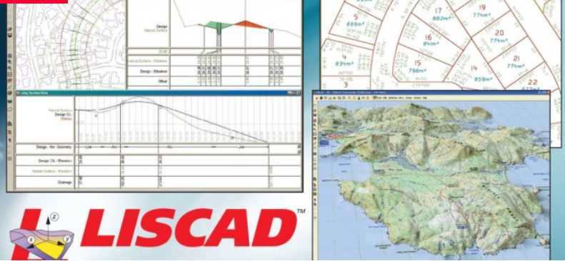
Leica LISCAD 2024 is a specialized surveying software developed by Leica Geosystems, a part of Hexagon AB. This advanced application is designed to provide high-accuracy geographic calculations, comprehensive project modeling, and real-time mapping capabilities, making it an essential tool for professionals in the geology, civil engineering, geospatial, and GIS industries. Its lineage from a company with a long history in geospatial technology positions LISCAD as a reliable solution for complex surveying tasks.
Introduction to Leica LISCAD 2024
Overview of the Software and Its Applications
Leica LISCAD 2024 serves as a powerful platform for complex geospatial data processing and analysis. It is widely adopted across various sectors, including civil engineering and geology, where precise measurements and detailed models are paramount. The software’s application spans from initial site surveys to detailed project planning and execution, supporting professionals worldwide in achieving accurate results.
Key Features of LISCAD 2024
Modular Functionality for Tailored Use
A significant advantage of Leica LISCAD 2024 is its modular structure. This design philosophy allows users to customize their software environment by selecting and purchasing only the specific modules they require for their projects. This approach ensures that professionals invest in the tools that directly address their workflow needs, enhancing efficiency and cost-effectiveness.
Geographic Calculations and Modeling Capabilities
Accuracy and Limitless Model Size
LISCAD 2024 is engineered to perform highly accurate geographic calculations, essential for precise surveying and engineering tasks. The software supports the creation and manipulation of extensive geospatial models, capable of handling unlimited data size. This characteristic makes it suitable for even the most demanding large-scale projects, ensuring that complexity and data volume do not compromise accuracy.
Real-Time Mapping and Integration
Utilizing Total Station and GNSS Technology
The software leverages advanced integration with Leica’s Total Station and GNSS technologies. This connectivity facilitates real-time mapping, allowing field engineers and surveyors to visualize, process, and edit geospatial data as it is collected on-site. This capability streamlines fieldwork, reduces the need for post-processing, and enables immediate decision-making based on current data.
Industry Applications and Use Cases
Serving Surveyors and Civil Engineers
Leica LISCAD 2024 finds critical applications within the surveying and civil engineering sectors. Surveyors utilize its precision for boundary mapping, topographic surveys, and construction site layout. Civil engineers rely on it for infrastructure design, earthworks calculations, and project visualization. The software’s robust features contribute to improved project efficiency and accuracy in diverse field scenarios, supporting the successful execution of complex engineering feats.
Comparison with Other Surveying Software
What Sets LISCAD Apart from Competitors
Leica LISCAD 2024 distinguishes itself through its distinctive modular approach, offering users a flexible and cost-effective solution tailored to specific professional requirements. Unlike some competitors offering monolithic software packages, LISCAD’s ability to procure individual, specialized modules ensures that users only pay for the functionality they need. Furthermore, its tight integration with Leica’s cutting-edge Total Station and GNSS hardware enables advanced real-time mapping capabilities that enhance fieldwork productivity.
Getting Started with LISCAD 2024
Installation and Initial Setup Considerations
Initiating work with Leica LISCAD 2024 involves a straightforward setup process designed to get professionals operational quickly. Users can expect a guided installation that configures the software based on the chosen modules. The intuitive design of LISCAD ensures that once installed, navigating its features for tasks such as performing geographic calculations or setting up real-time mapping sessions is user-friendly, even for those new to the platform.
Frequently Asked Questions
What industries primarily use Leica LISCAD?
Leica LISCAD is predominantly used in surveying, civil engineering, geology, and various applications within the GIS sector, due to its robust capabilities in geographic data processing and modeling. Its accuracy and flexibility make it suitable for professionals who require precise geospatial information.
How does LISCAD facilitate real-time mapping?
LISCAD integrates seamlessly with modern mapping devices such as Total Stations and GNSS systems, allowing users to visualize and edit geospatial models in real-time directly on-site. This direct data flow streamlines fieldwork and improves project accuracy by enabling immediate visual feedback.
Can LISCAD handle large-scale geospatial projects?
Yes, LISCAD is capable of managing models of unlimited size, ensuring precise calculations and visualizations even for extensive surveying projects. This scalability is crucial for large infrastructure developments, regional mapping, and other complex geospatial endeavors.


Reviews
There are no reviews yet.