
Download rapidlasso LAStools Suite 2026 – Efficient LiDAR Data Processing Software
The rapidlasso LAStools Suite 2026 is a specialized collection of geospatial software developed by rapidlasso GmbH, designed for efficient processing and analysis of Lidar data. It is particularly relevant for professionals in the Environmental & Earth Sciences sector, supporting applications in environmental monitoring, forestry, and urban planning. This suite is engineered to handle large Lidar datasets with remarkable speed and minimal memory consumption, making it a crucial tool for data-intensive geospatial workflows.
Introduction to LAStools Suite
The LAStools Suite serves as a powerful toolkit for managing and interpreting the vast amounts of data generated by Lidar sensors. Its primary function revolves around the efficient processing of Lidar point clouds, offering a wide array of tools for data manipulation, classification, and conversion. Within the field of Environmental & Earth Sciences, the suite is instrumental in tasks ranging from detailed terrain modeling to comprehensive forest inventory analysis, enabling more accurate and informed decision-making in critical areas of environmental management and urban development.
Key Features of LAStools Suite
Efficient Lidar Data Handling
A cornerstone of the LAStools Suite is its exceptional performance when dealing with large Lidar datasets. The software is meticulously optimized for speed and memory efficiency, allowing users to process billions of points with significantly less RAM compared to many traditional solutions. This capability is critical for handling the extensive datasets common in modern Lidar surveys, ensuring that complex analyses can be completed in a timely manner without requiring high-end hardware.
Comprehensive Toolset for Geospatial Applications
The LAStools Suite encompasses a broad range of individual tools, each tailored for specific geospatial tasks. These command-line driven utilities can be integrated into scripts for automated batch processing, offering immense flexibility. Notable tools include:
- lasview: A fast Lidar viewer for quick visualization and data inspection.
- lasclassify: Advanced algorithms for automated point cloud classification, distinguishing between ground, vegetation, buildings, and other features.
- lasgrid: Tools for gridding Lidar data to create digital elevation models (DEMs) and digital surface models (DSMs).
- laslaz: Efficient compression and decompression utilities for working with LAZ, the compressed version of the LAS standard.
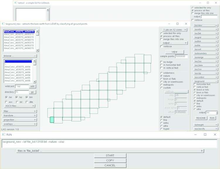
- lasground: Algorithms to generate high-accuracy digital terrain models by classifying ground points.
This extensive collection ensures that most Lidar processing workflows can be managed within the LAStools environment.
Integration with Popular GIS Software
The LAStools Suite is designed for seamless integration with leading Geographic Information System (GIS) platforms. This compatibility ensures that professionals can incorporate LAStools’ powerful processing capabilities into their existing workflows without significant disruption. The suite works effectively with:
- ArcGIS: Users can leverage LAStools through various integration methods, enhancing its analytical functions within the Esri ecosystem.
- QGIS: The open-source nature of QGIS allows for straightforward integration, often via plugins or direct command-line calls, extending its Lidar processing capabilities.
- ERDAS IMAGINE: Professionals using ERDAS IMAGINE can also benefit from LAStools for specialized Lidar data handling tasks.
This broad compatibility makes the LAStools Suite a versatile addition to any geospatial analyst’s toolkit.
Real-World Applications
The LAStools Suite is extensively utilized across various demanding industries. Its robust capabilities are applied to critical tasks such as:
- Forestry: Detailed forest inventory analysis, including species identification, canopy height modeling, and biomass estimation.
- Urban Planning: Infrastructure assessment, city modeling, and analysis of urban sprawl, supporting efficient city management and development strategies.
- Environmental Monitoring: Change detection studies, flood risk assessment, and coastal erosion monitoring through precise terrain and surface modeling.
- Agriculture: Precision farming applications, including detailed soil analysis and crop health monitoring.
- Engineering and Surveying: High-accuracy terrain modeling for construction projects, land surveying, and infrastructure design.
These applications highlight the software’s pivotal role in extracting actionable insights from complex Lidar datasets.
Advantages of Using LAStools Suite
LAStools Suite distinguishes itself through several key advantages that appeal to geospatial professionals:
- Speed and Efficiency: Its unparalleled processing speed and low memory footprint allow for rapid analysis of massive datasets, often outperforming comparable software.
- Comprehensive Functionality: The suite offers a vast array of specialized tools covering nearly all aspects of Lidar data processing, from initial filtering to advanced classification and DTM generation.
- Customization and Automation: The command-line interface facilitates scripting and batch processing, enabling users to automate complex workflows and tailor operations to specific project needs.
- Cost-Effectiveness: While offering commercial licenses for extended use, the suite provides a powerful, efficient solution that is often more economical than alternatives, especially considering its performance on standard hardware.
- Community Support: Though direct Wikipedia coverage is limited, the software is widely recognized and used within the geospatial community, with many users sharing expertise and workarounds.
These factors collectively contribute to its reputation as a highly effective solution for Lidar data processing challenges.
Conclusion
The rapidlasso LAStools Suite 2026 represents a significant advancement in Lidar data processing technology. Its combination of speed, memory efficiency, a comprehensive toolset, and broad GIS compatibility makes it an indispensable resource for professionals in environmental sciences and other geospatial fields. By enabling efficient handling and insightful analysis of Lidar data, LAStools empowers users to undertake complex projects in areas like urban planning, forestry, and environmental monitoring with greater accuracy and speed.
Frequently Asked Questions
What is the LAStools Suite primarily used for?
The LAStools Suite is primarily used for processing and analyzing Lidar data, enabling efficient classification, filtering, and data conversion for various applications in geospatial sciences. It allows professionals to transform raw Lidar point clouds into valuable datasets for tasks like terrain modeling, object detection, and environmental assessment.
How does LAStools Suite improve performance with Lidar data?
LAStools Suite is designed to maximize memory efficiency and processing speed, allowing for quick handling and analysis of billions of Lidar data points with minimal resource consumption. This optimized performance is achieved through sophisticated algorithms and data management techniques, ensuring rapid results even with extremely large datasets.
Can LAStools Suite tools be used with any GIS platform?
While LAStools Suite tools are compatible with major GIS platforms like ArcGIS and QGIS, it is advisable to check specific requirements or integration methods to ensure optimal performance. The suite is primarily command-line driven, which allows for integration into various scripting environments and GIS workflows, though specific plugin availability may vary.


Reviews
There are no reviews yet.