
Download LiMON 4.0 – Advanced Point Cloud and LiDAR Data Processing Software
LiMON 4.0 is a specialized software application designed for advanced processing, visualization, and management of LiDAR and UAV point cloud data. Developed for geospatial professionals, it caters to the intricate needs of industries such as oil and gas, energy, surveying, and environmental monitoring. This software provides robust tools for handling large datasets, enabling detailed 3D analysis and collaborative project workflows through its integrated LiMON Server connectivity.
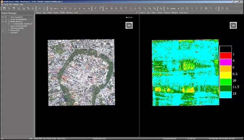
Comprehensive 3D Visualization and Multi-Angle Data Display
LiMON 4.0 offers an advanced visualization engine capable of displaying point cloud data from up to four simultaneous views. Users can leverage multiple display modes, including RGB, Intensity, Elevation, and Classification, to interpret the data comprehensively. The software supports the creation of 3D surfaces with flexible rendering options. These include solid, wireframe, and detailed rendering modes, allowing for highly customizable visual analysis of complex spatial environments.
Flexible 3D Model Support and Geospatial Data Integration
The software facilitates the integration of diverse geospatial datasets by supporting a wide array of 3D model formats such as GML, OBJ, IFC, 3DS, DAE, and FBX. Essential transformation tools for shifting, rotating, and scaling these models are included to ensure accurate scene composition. Furthermore, LiMON 4.0 integrates seamlessly with Web Map Services (WMS) and common raster formats like JPG, TIFF, and ECW, providing critical geospatial context and enhancing analytical capabilities by overlaying various data sources onto the point cloud.
Advanced Point Cloud Classification and Editing Tools
LiMON 4.0 provides sophisticated tools for point cloud classification, enabling users to categorize data for detailed analysis. It features both manual and automatic classification methods, allowing for custom classification schemes tailored to specific project requirements. Spatial classification tools, such as rectangle, corridor, and intensity-based classification, empower users to precisely segment and label different features within the point cloud. The software emphasizes precision editing and superior data control, ensuring high accuracy in analysis and reporting.
Seamless Collaboration through LiMON Server Connectivity
Enhancing project efficiency, LiMON 4.0 integrates with LiMON Server to support distributed and collaborative data workflows. This connectivity allows for remote data sharing, efficient project selection, and density-adaptive visualization over both Local Area Networks (LAN) and Wide Area Networks (WAN). Users benefit from smooth LiDAR data downloading and the ability to read metadata remotely, facilitating teamwork across different locations and ensuring all project members work with the most current data.
UAV Data Processing and Precision Geospatial Analysis
Specialized functionalities within LiMON 4.0 are dedicated to processing Unmanned Aerial Vehicle (UAV) data. This includes tools for point cloud alignment, Ground Control Point (GCP) fitting, and coverage classification, optimizing data from aerial surveys. Quality coloring features help assess data accuracy and completeness. The software also supports the generation of key geospatial products, such as Digital Terrain Models (DTM), Digital Surface Models (DSM), Canopy Height Models (CHM), and contour lines, vital for detailed environmental and infrastructure analysis.
High-Precision Measurement and Coordinate System Capabilities
LiMON 4.0 is equipped with robust measurement tools designed for high-precision geospatial analysis. Users can accurately measure 3D distances, areas, and volumes, with advanced snapping functions ensuring drawing accuracy when creating annotations or models. The software’s comprehensive support for EPSG coordinate systems and dynamic coordinate transformations allows for seamless integration with existing spatial data infrastructure and ensures that calculations and visualizations are performed within the correct geodetic framework.
Camera and Profile Management for Detailed Project Documentation
Detailed camera controls are a key feature of LiMON 4.0, offering options for position, focal length, and clipping boxes to define specific view extents. Dynamic adjustment of views aids in focused analysis. The software also supports the creation of detailed profiles, complete with dimensioning modules and output to various formats including image files and DXF. Vector support for points, lines, and shapes within these profiles further enhances its utility for precise project documentation and reporting.
Frequently Asked Questions
How does LiMON 4.0 handle UAV LiDAR data differently from traditional point cloud software?
LiMON 4.0 offers specialized tools for UAV data, including alignment of point clouds, Ground Control Point (GCP) fitting, and excess coverage classification, enabling precise and efficient processing tailored to UAV survey data. These focused capabilities ensure that the unique characteristics and requirements of aerial LiDAR acquisition are effectively managed.
Can LiMON 4.0 be used collaboratively across multiple users or sites?
Yes, through integration with LiMON Server, users can remotely access, share, and visualize LiDAR datasets over LAN or WAN networks, ensuring efficient project collaboration and data management. This connectivity allows distributed teams to work together seamlessly on complex geospatial projects.
What formats of 3D models and geospatial data does LiMON 4.0 support?
LiMON 4.0 supports a variety of popular 3D model formats including GML, OBJ, 3DS, DAE, FBX, and IFC, as well as raster formats through Web Map Services like JPG, TIFF, and ECW, allowing versatile data integration. This broad compatibility ensures it can fit into diverse existing geospatial workflows.


Reviews
There are no reviews yet.