
Download Golden Software Didger – Powerful Mapping Software for Digitalization
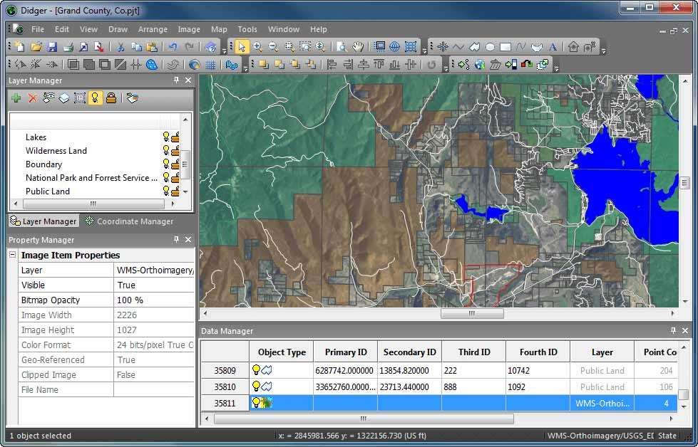
Golden Software Didger is a specialized mapping software developed by Golden Software LLC, a company with a long history in GIS applications dating back to 1983. First released in 1996, Didger plays a crucial role in the Geographic Information Systems (GIS) sector by facilitating the digitalization of maps and various geographic data. It is designed for professionals in fields such as GIS and Environmental Science who require robust tools for converting, analyzing, and visualizing spatial information.
Overview of Golden Software Didger
Introduction to Digital Mapping Applications
Golden Software Didger emerged as a key tool in 1996 to address the growing need for digital map data, a critical component for Geographic Information Systems (GIS). The software allows users to transform analog maps and images into usable digital formats. This capability is foundational for modern geospatial analysis, enabling users to leverage existing hard-copy resources within digital workflows. Didger’s development by Golden Software LLC, a company established in 1983, reflects a deep understanding of the geospatial software market and its evolving demands.
Key Features and Capabilities of Didger
Advanced Digitization Tools
Didger offers a suite of advanced tools designed for precise data digitization, a core requirement for creating accurate digital maps. The software assists users in converting various forms of geographic information, including paper maps and raster images, into vector data that can be further processed and analyzed. Key functionalities include:
- Automated Digitization: Tools that help in the semi-automated conversion of image data into vector features, significantly reducing manual effort.
- Custom Coordinate Systems: Support for defining and working with various coordinate systems, ensuring accurate spatial referencing and integration with other GIS data.
- Data Transformation: Capabilities to transform and reproject spatial data as needed for specific project requirements or compatibility with different datasets.
Supported File Formats and Integration
Comprehensive Data Support
A significant strength of Golden Software Didger lies in its extensive compatibility with a wide array of file formats. This broad support ensures seamless integration into existing geospatial workflows, allowing users to import data from diverse sources and export their digitized maps into numerous application-ready formats. Didger supports common GIS formats such as:
- Vector Formats: Including Shapefile (.SHP), DXF (Drawing Exchange Format), and others crucial for GIS analysis.
- Raster Formats: Supporting image formats like GeoTIFF (.TIF), BMP, and JPG for georeferencing and digitization.
- Tabular Data: Compatibility with spreadsheet formats like Excel (.XLSX) for integrating attribute data.
This comprehensive file format support streamlines data handling and enhances interoperability between Didger and other software used in GIS and environmental science projects.
Applications in Environmental Science and Geospatial Analysis
Real-World Use Cases
Golden Software Didger finds extensive application across various professional fields, particularly where precise mapping and geospatial analysis are paramount. Its ability to digitize and manage spatial data makes it invaluable for projects requiring detailed geographic information. Common applications include:
- Environmental Science: Used for digitizing boundaries of conservation areas, mapping vegetation types, or analyzing geological survey maps to understand environmental impact and resource distribution.
- Urban Planning: Professionals employ Didger to convert old city plans or survey maps into digital formats, aiding in infrastructure development, zoning analysis, and land-use planning.
- Natural Resource Management: Applications include mapping forest stands, delineating water bodies, and analyzing mineral exploration data.
- Geological Surveys: Facilitates the digitalization of geological fault lines, rock formations, and borehole data from paper logs and maps.
These real-world use cases highlight Didger’s role in enhancing project efficiency and decision-making through accurate digital mapping and geospatial analysis.
Getting Started with Golden Software Didger
Accessing Online Resources
Golden Software Didger provides users with various online resources to facilitate learning and application. Through its online mapping capabilities, users can often access publicly available spatial data, which can then be imported into Didger for further processing. The Golden Software website also typically offers tutorials, documentation, and support forums. These resources are essential for users looking to maximize the software’s potential, whether they are new to digital mapping or experienced GIS professionals.
Why Choose Didger Over Other GIS Software?
Comparative Advantages
Golden Software Didger differentiates itself within the competitive GIS software landscape through its specialized focus on efficient map digitalization and broad file format compatibility. While many GIS platforms offer broad analytical capabilities, Didger excels in the initial stages of data preparation, particularly for users working with legacy paper maps or scanned imagery. Its key advantages include:
- Specialized Digitization Tools: Dedicated features simplify the often time-consuming process of converting raster data to vector formats, making it more user-friendly than general-purpose GIS packages.
- Extensive File Format Support: The program’s ability to import and export a vast number of geospatial file types ensures it can integrate smoothly into diverse data environments, reducing the need for complex data conversion utilities.
- User-Centric Design: Developed by Golden Software LLC, known for its intuitive interfaces, Didger aims to provide powerful functionality in a way that is accessible and efficient for its target users.
These factors make Didger a powerful choice for professionals prioritizing accurate data conversion and integration into their existing GIS workflows.
Frequently Asked Questions
What is Golden Software Didger used for?
Golden Software Didger is primarily used for digital mapping, allowing users to convert paper maps and scanned images into usable digital formats that can be subsequently analyzed and manipulated within GIS software. It supports a wide variety of file formats pertinent to geospatial analysis and data integration, serving as a crucial tool for digitizing geographic information.
Can Didger handle multiple file formats?
Yes, Golden Software Didger supports a comprehensive range of file formats, including common geospatial types such as Shapefile (.SHP), DXF, PDF, TIF, and XLSX. This extensive compatibility makes it a versatile tool for various data import and export requirements, ensuring seamless integration into diverse digital mapping workflows.
What industries benefit from using Golden Software Didger?
Industries such as environmental science, urban planning, natural resource management, geology, and engineering greatly benefit from using Didger. Its specialized mapping and geospatial analysis capabilities, particularly in digitizing existing maps and data, enhance decision-making processes and project efficiency across these varied professional sectors.


Reviews
There are no reviews yet.