
Download AlgoMesh – Advanced Mesh Generation Software for Hydrogeology
AlgoMesh software is a specialized application designed for generating unstructured triangular and Voronoi grids, primarily serving professionals in hydrogeology and environmental engineering. It plays a critical role in preparing input files for complex groundwater flow simulation software such as MODFLOW, thereby enhancing the efficiency and accuracy of hydrological modeling projects.
Introduction to AlgoMesh
What is AlgoMesh?
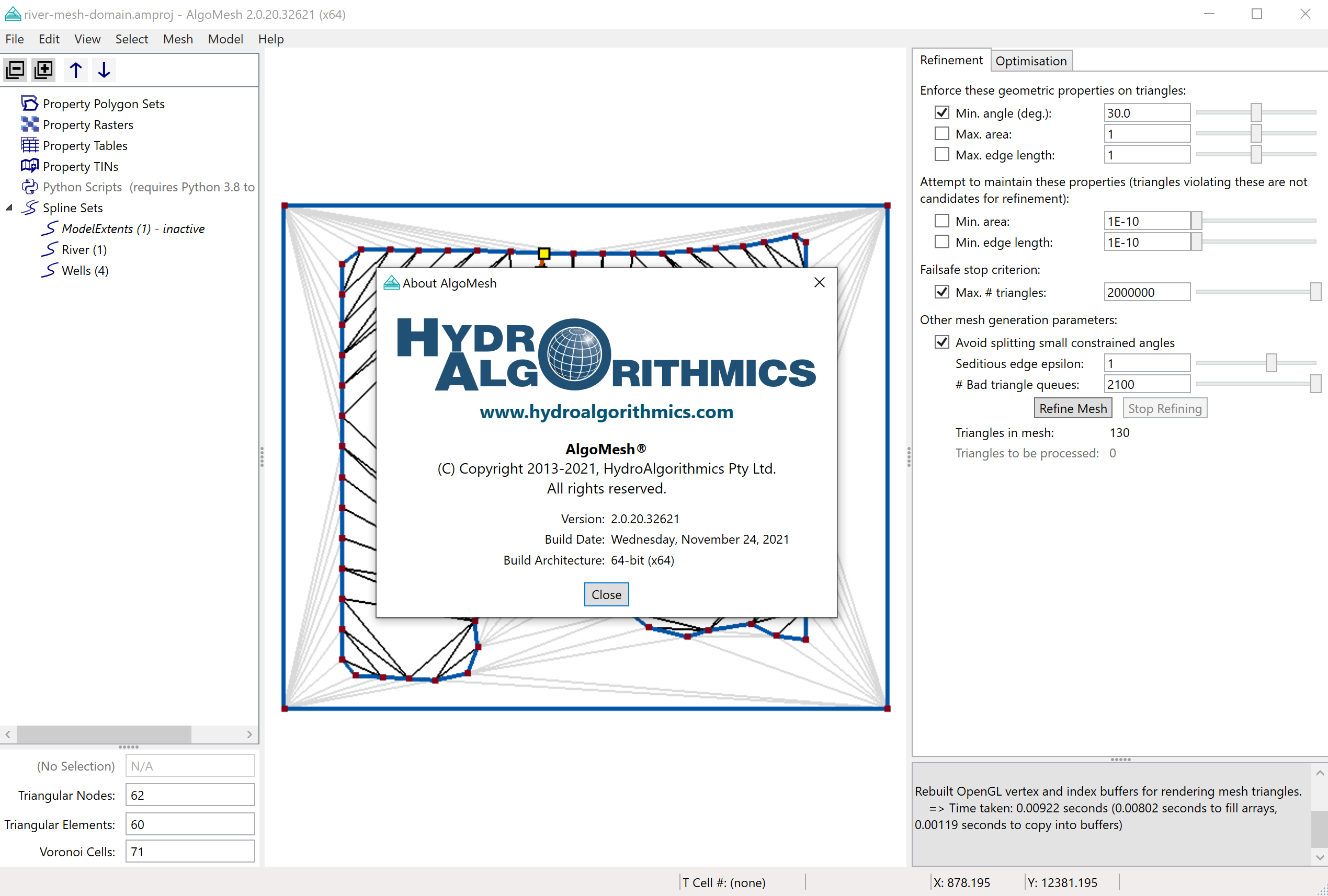
AlgoMesh is a robust mesh generation software tool developed to create the precise grid structures required for advanced hydrological simulations. Its core function involves the automated generation of unstructured triangular and Voronoi grids, which are essential for representing complex geological and geographical terrains in numerical models. The software facilitates the creation of input files for widely used simulation packages, streamlining the workflow for environmental scientists and hydrogeologists.
Key Features and Enhancements in Version 2.0
Automated Geometry Clean-Up
Version 2.0 of AlgoMesh introduces significant workflow improvements, including automated geometry clean-up routines. These features automatically identify and resolve common geometric inconsistencies in input data, reducing manual correction time and minimizing errors before mesh generation begins. This automation is crucial for handling complex geospatial data effectively.
Faster Mesh Generation
AlgoMesh has been optimized for performance, offering significantly faster mesh generation compared to previous versions or alternative methods. This enhancement allows users to create detailed and complex meshes more rapidly, expediting the overall simulation setup process and enabling quicker iteration on model designs.
Expanded Export Options
The software provides a variety of model and mesh export options, catering to diverse simulation environments and analytical needs. Users can export generated meshes in multiple industry-standard formats, ensuring compatibility with a wide range of simulation and visualization software beyond its primary MODFLOW integration. This flexibility supports interdisciplinary workflows and data sharing.
Applications of AlgoMesh
Use in Hydrogeology
In hydrogeology, AlgoMesh is indispensable for generating input grids for numerical groundwater flow models. It provides essential mesh generation capabilities for tools like MODFLOW and HydroGeoSphere, enabling the realistic simulation of groundwater movement and contaminant transport. The software’s ability to create high-quality unstructured grids is vital for accurately representing heterogeneous subsurface conditions.
Integration with GIS
AlgoMesh supports integration with Geographic Information System (GIS) data, allowing users to import project boundaries and geological features directly from GIS raster files. This capability enhances the visualization of model outputs and ensures that the generated meshes accurately reflect the spatial characteristics of the study area, improving the contextual relevance of simulation results.
Mesh Quality and Analysis Tools
Ensuring the quality of generated meshes is paramount for the accuracy of numerical simulations. AlgoMesh incorporates tools for mesh quality analysis, allowing users to inspect critical mesh cell metrics. This includes the capability to compare cell quality based on various built-in metrics, permitting users to identify and correct problematic areas within the mesh before it is used in simulation software, thereby guaranteeing more reliable model outputs.
Real-World Applications
AlgoMesh has proven to be a valuable asset in numerous hydrogeological projects, particularly those requiring detailed groundwater flow simulations. For instance, environmental consultants use AlgoMesh to prepare input meshes for models assessing groundwater contamination plumes or evaluating the impact of surface water management strategies. The efficient generation of unstructured triangular and Voronoi grids greatly aids in capturing complex geological formations and hydraulic boundary conditions encountered in real-world environmental scenarios.
Conclusion and Getting Started with AlgoMesh
AlgoMesh software offers indispensable capabilities for hydrogeologists and environmental engineers involved in groundwater modeling. Its strength lies in its efficient generation of unstructured grids, seamless MODFLOW integration, and advanced features like automated geometry clean-up and comprehensive export options, particularly with enhancements introduced in Version 2.0. By providing reliable mesh generation tools and supporting GIS integration, AlgoMesh significantly contributes to more accurate and efficient hydrological simulations.
Frequently Asked Questions
What is AlgoMesh used for?
AlgoMesh is utilized for generating unstructured triangular and Voronoi grids, primarily for creating input files for groundwater simulation tools like MODFLOW. Its core purpose is to provide accurate and efficient mesh representations of geological terrains for numerical modeling in hydrogeology.
How does AlgoMesh ensure mesh quality?
AlgoMesh includes a mesh quality analysis tool that allows users to inspect and compare mesh cell quality through built-in metrics, ensuring robust and functional meshes for simulations. This feature helps in identifying and rectifying any potential issues within the generated mesh before its use in simulation software.
Can AlgoMesh import GIS data?
Yes, AlgoMesh can load GIS raster files directly into projects, facilitating better visualization and mapping of model variables in simulations. This integration allows for models to be more accurately aligned with real-world geographic and geological data.


Reviews
There are no reviews yet.