Download Carlson SurveyGNSS – Advanced GNSS Post-Processing Software
Carlson SurveyGNSS is an advanced post-processing software developed by Carlson Software, a prominent US-based company specializing in civil engineering and construction solutions. This application is specifically designed for surveying and positioning professionals, enabling them to achieve high-accuracy results by processing raw GNSS data. It is an integral tool for users in the civil engineering and construction sectors who require precise geospatial information.
Overview of Carlson SurveyGNSS
Purpose and Key Applications
Carlson SurveyGNSS serves as a crucial tool for geospatial professionals, enhancing the accuracy and reliability of surveying data. Its primary purpose is to process raw GNSS (Global Navigation Satellite System) observations collected in the field and transform them into precise coordinate information. This makes it indispensable for applications demanding sub-centimeter positioning, such as cadastral surveys, topographic mapping, construction layout, and infrastructure development projects.
Core Functionalities of SurveyGNSS
Data Processing Capabilities
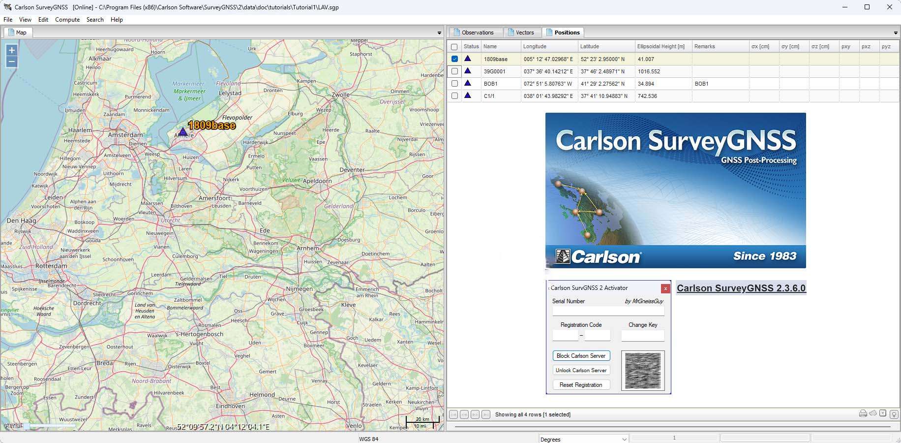
SurveyGNSS offers robust capabilities for processing various types of GNSS data, significantly contributing to achieving high accuracy in surveying projects. The software supports the processing of static, kinematic, and “stop & go” data formats. It is designed to read and process data in the universally recognized RINEX (Receiver Independent Exchange) format, ensuring compatibility with data collected from a wide range of GNSS receivers. This comprehensive approach to data handling allows for detailed analysis and refinement of collected measurements.
Integration and Compatibility
Seamless Workflow with Carlson Software
A key strength of Carlson SurveyGNSS lies in its seamless integration within the broader Carlson Software ecosystem. It is engineered to work harmoniously with other Carlson products, including Carlson SurvCE and Carlson SurvPC, which are widely used for data collection in the field. This integration facilitates a smooth transition of data from field collection to post-processing, creating an efficient and connected workflow for surveying professionals. Users benefit from a unified software environment that reduces data transfer complexities and potential errors.
High Accuracy Results
Techniques for Precise Positioning
Carlson SurveyGNSS employs sophisticated algorithms and methodologies to deliver sub-centimeter positioning accuracy. Among its advanced techniques is Precise Point Positioning (PPP), which allows for high-accuracy positioning without relying on local base stations by using precise satellite orbit and clock data. Additionally, the software utilizes least squares adjustment, a statistical method for finding the best fit for a set of measurements, ensuring that the final coordinates are as precise as possible under various field conditions, even in the absence of real-time correction services.
Real-World Applications
Use Cases in Civil Engineering and Surveying
The practical applications of Carlson SurveyGNSS span numerous demanding scenarios within civil engineering and surveying. Professionals leverage this software for critical tasks such as establishing control networks for large-scale construction projects, performing precise topographic surveys for infrastructure design, conducting boundary retracement and legal surveys, and analyzing deformation monitoring data. Its ability to provide reliable, high-accuracy positioning in challenging environments makes it invaluable for ensuring the integrity and success of complex engineering endeavors.
Comparison With Competitors
How SurveyGNSS Stands Out in the Market
Carlson SurveyGNSS differentiates itself in the competitive GNSS post-processing software market through a combination of advanced technical capabilities and integrated workflow solutions. While many software packages offer GNSS data processing, SurveyGNSS’s primary differentiator is its tight integration with Carlson’s field data collection software, creating a cohesive and efficient user experience. Furthermore, its robust support for multiple GNSS constellations (GPS, GLONASS, Galileo, BeiDou) and advanced positioning techniques like PPP and least squares adjustment ensure highly accurate results, even in difficult surveying conditions often encountered by civil engineers and surveyors.
Frequently Asked Questions
What types of GNSS data can Carlson SurveyGNSS process?
Carlson SurveyGNSS can process static, kinematic, and “stop & go” raw GNSS data, including RINEX format from various GNSS receivers. This flexibility makes it suitable for diverse surveying applications.
How does SurveyGNSS achieve high accuracy in GNSS positioning?
The software utilizes advanced techniques such as Precise Point Positioning (PPP) and least squares adjustment to ensure centimeter-level accuracy, even in areas with limited real-time corrections.
Does Carlson SurveyGNSS work with multiple GNSS constellations?
Yes, SurveyGNSS is optimized for processing data from all major GNSS constellations, including GPS, GLONASS, Galileo, and BeiDou, providing comprehensive support for international surveying needs.


Reviews
There are no reviews yet.