
Download DynaView 3.0 – Advanced 3D Geological Modeling Software
DynaView 3.0 is an advanced 3D geological modeling and monitoring platform designed for professionals in the oil and gas exploration, geological modeling, and geosciences sectors. Developed to address the complexities of subsurface assessment, this software integrates seismic and well data to significantly reduce uncertainties in geological evaluations and enhance the efficiency of drilling operations, making it a vital tool for predictive modeling in geoscience.
Introduction to DynaView 3.0
Overview and Key Objectives
DynaView 3.0 serves as an integrated platform focused on creating detailed 3D geological models. Its primary objective is to bridge the gap between diverse geological datasets, such as seismic surveys and borehole logs, to provide a more accurate and predictive understanding of subsurface conditions. The software is tailored for geoscientists, geophysicists, and reservoir engineers involved in exploration and production within the energy sector.
Core Features of DynaView 3.0
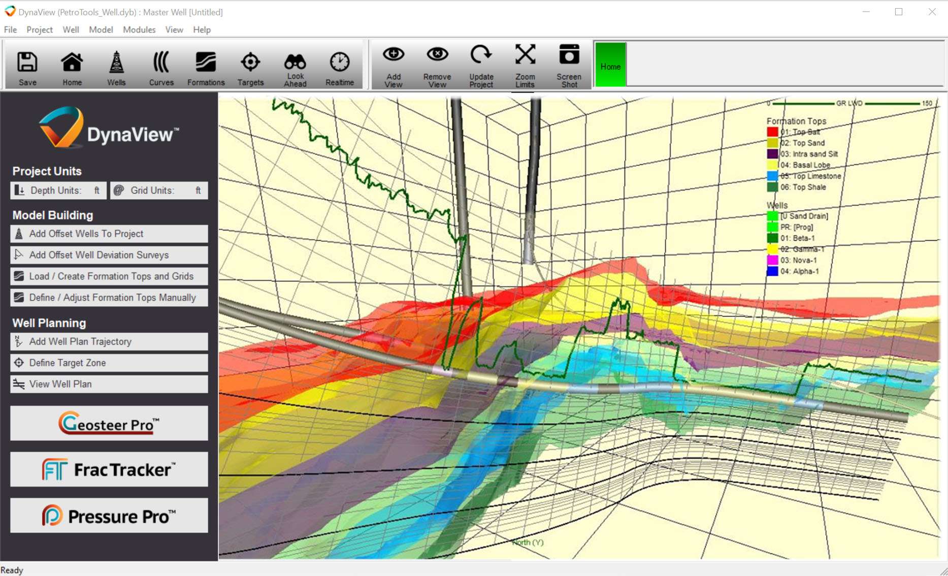
3D Modeling Capabilities
DynaView 3.0 offers robust tools for constructing detailed three-dimensional geological models. These capabilities allow for the visualization and analysis of subsurface structures, facilitating a deeper comprehension of geological formations and their spatial relationships. The platform supports complex modeling workflows essential for accurate geophysical simulation.
- Creation of complex geological structures and layers in 3D space.
- Visualization of faults, horizons, and stratigraphic layers based on integrated data.
- Tools for refining and validating geological models against input data.
Integration with Data Sources
A key strength of DynaView 3.0 lies in its ability to seamlessly integrate various data types in real-time. It efficiently processes seismic information and well log data, ensuring that the geological models are constantly updated and informed by the latest available field information. This facilitates sophisticated statistical analysis and enhances the reliability of predictive modeling.
- Real-time integration of seismic survey data.
- Import and processing of multi well data, including petrophysical attributes.
- Advanced algorithms for data fusion and reconciliation.
Applications in the Geosciences
In the geosciences, particularly within the oil and gas industry, DynaView 3.0 is instrumental in refining exploration strategies and optimizing field development. Its advanced predictive modeling capabilities help identify potential hydrocarbon reservoirs more accurately and mitigate risks associated with exploratory drilling. The software supports detailed geological assessments for improved resource management.
- Enhanced identification and characterization of subsurface reservoirs.
- Improved planning and execution of drilling campaigns.
- Support for reservoir simulation and management workflows.
- Reduction of geological uncertainties crucial for investment decisions.
Advantages of Using DynaView 3.0
DynaView 3.0 provides significant advantages by directly tackling the inherent geological uncertainties in exploration projects. Its sophisticated statistical analysis and real-time monitoring tools provide geoscientists with enhanced insight, leading to more informed decision-making. This ultimately contributes to increased operational efficiency and better economic outcomes in challenging geological environments.
- Quantification and reduction of geological uncertainties in subsurface models.
- Real-time monitoring for dynamic geological changes.
- Improved accuracy in predicting reservoir properties and behavior.
- Streamlined workflows for complex geophysical simulation tasks.
Comparative Analysis with Competitors
While several geophysical simulation software packages exist, DynaView 3.0 distinguishes itself through its specialized focus on integrating real-time seismic and well data for predictive geological modeling. Some competitor tools may offer broader functionalities, but DynaView’s strength lies in its intelligent data handling and statistical analysis capabilities that directly address the challenges of dynamic subsurface environments and reduce critical geological uncertainties.
Real-World Use Cases
DynaView 3.0 has been applied in numerous geological projects to improve subsurface understanding and operational success. For instance, exploration teams have utilized the software to generate high-resolution 3D models of complex fault systems, leading to more successful well placement and reduced drilling risks. In mature fields, it has aided in reassessing reservoir potential by integrating new seismic data, uncovering previously overlooked zones for development.
- Successful identification of new exploration targets through detailed 3D structural modeling.
- Optimization of infill drilling programs by precisely mapping reservoir compartments.
- Reduction in drilling non-productive time (NPT) by anticipating geological hazards.
Frequently Asked Questions
What is DynaView 3.0 used for?
DynaView 3.0 is primarily used for 3D geological modeling, integrating seismic and real-time data to reduce uncertainties in drilling and improve overall well performance. It provides a comprehensive platform for visualizing and analyzing subsurface geological structures crucial for exploration and production.
How does DynaView 3.0 improve drilling performance?
By utilizing predictive modeling techniques, DynaView 3.0 enables users to visualize geological conditions and make informed decisions ahead of drilling, thus mitigating risks associated with unexpected geo-hazards. This proactive approach helps in optimizing well trajectories and operational planning, leading to improved drilling efficiency.
Can DynaView handle multiple wells simultaneously?
Yes, DynaView 3.0 supports the simultaneous analysis and importing of multi well data, allowing users to develop comprehensive geological models that account for variations across different wells. This capability is essential for understanding reservoir connectivity and heterogeneity across a development area.


Reviews
There are no reviews yet.