
Download Pitney Bowes MapInfo Pro – Advanced GIS and Mapping Software
Pitney Bowes MapInfo Pro is a leading GIS software developed by Pitney Bowes, designed for sophisticated mapping and spatial analysis. It serves GIS Analysts, Geospatial Planners, and Business Analysts, enabling them to visualize geographic data and perform comprehensive analysis. The software leverages powerful analytical tools to provide insights across various industries that rely heavily on spatial data.
Overview of Pitney Bowes MapInfo Pro
Pitney Bowes MapInfo Pro is a professional-grade mapping and spatial analysis application. It provides users with the tools necessary to create, manage, and visualize geographic information, facilitating a deeper understanding of spatial relationships. This software is instrumental for professionals who need to interpret and act upon location-based data.
Applications in Geospatial Analysis
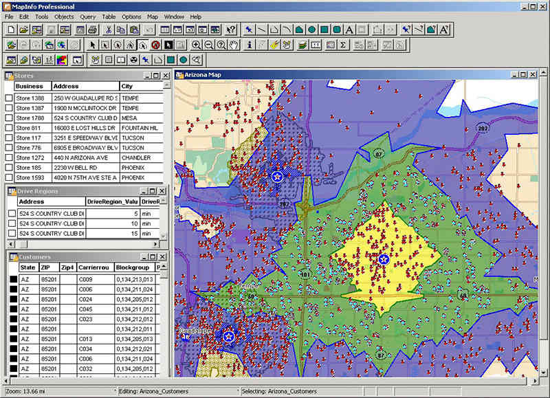
The field of geospatial analysis benefits significantly from MapInfo Pro’s advanced capabilities. Professionals across diverse sectors utilize the software for tasks ranging from detailed site selection to complex environmental modeling. Its robust functionality supports a wide array of applications where spatial data is a critical component of operational strategy and decision-making.
- Urban planning and infrastructure development
- Retail location analysis and market segmentation
- Environmental management and resource monitoring
- Public safety and emergency response planning
- Logistics and transportation route optimization
Key Capabilities and Features
MapInfo Pro is recognized for its comprehensive feature set that enhances spatial data visualization and analysis. The software empowers users to work efficiently with geographic information and derive actionable insights.
- Advanced mapping tools for creating custom maps
- Robust spatial analysis functions including buffering, overlay, and proximity analysis
- Data integration capabilities to combine information from various sources
- Tools for thematic mapping and data visualization to highlight patterns and trends
- User-friendly interface designed to streamline complex geospatial workflows
File Formats and Compatibility
MapInfo Pro ensures broad compatibility through its support for a wide range of industry-standard file formats. This allows seamless integration with existing data infrastructures and facilitates collaboration among different teams and systems.
- Supports numerous vector and raster data formats common in Windows environments.
- Facilitates the import and export of data, ensuring flexibility in data management workflows.
- Compatibility with various database systems for efficient data access and analysis.
User Scenarios: Real-World Applications
Businesses and organizations leverage Pitney Bowes MapInfo Pro to address specific operational challenges and improve strategic planning through location-based intelligence. The software’s versatility makes it applicable to numerous real-world scenarios.
- A retail company uses MapInfo Pro to analyze demographic data and identify optimal locations for new store openings, thereby increasing market penetration.
- An environmental agency employs the software to map and monitor pollution sources, aiding in the development of effective remediation strategies.
- A city planning department utilizes MapInfo Pro to visualize zoning regulations, infrastructure, and population density, supporting informed urban development decisions.
- A logistics firm uses spatial analysis to optimize delivery routes, reducing transit times and fuel costs.
Comparison to Other GIS Tools
Compared to many other GIS tools, Pitney Bowes MapInfo Pro distinguishes itself through a combination of a user-friendly interface and powerful analytical features. While other GIS software may offer specialized toolkits, MapInfo Pro often provides a balanced approach that is accessible to a broad range of professionals. Its strength lies in enabling users to visualize and analyze spatial data effectively without an overly steep learning curve, making it a practical choice for many business applications.
Conclusion: Empowering Decisions with MapInfo Pro
Pitney Bowes MapInfo Pro serves as a vital tool for professionals engaged in geospatial analysis and mapping. Its comprehensive capabilities empower users to visualize complex spatial data, conduct in-depth analysis, and uncover critical insights. By facilitating informed decision-making through a better understanding of location-based information, MapInfo Pro supports strategic planning and operational efficiency across numerous industries.
Frequently Asked Questions
What types of data formats does MapInfo Pro support?
MapInfo Pro supports a wide range of data formats, including popular file types commonly used in Windows, enabling seamless integration and analysis of diverse datasets. This broad compatibility ensures that users can easily work with data from various sources without extensive conversion processes.
How does MapInfo Pro assist in business decision-making?
By providing rich visualizations and analytics capabilities, MapInfo Pro helps businesses identify patterns and trends in spatial data, leading to more strategic and informed decision-making. Users can analyze customer demographics, market potential, and operational efficiency to make data-driven choices that enhance business outcomes.
What industries primarily use MapInfo Pro?
MapInfo Pro is widely utilized in various sectors including urban planning, environmental management, marketing, and logistics, where spatial analysis is crucial for operations. Professionals in these fields leverage the software to gain spatial insights that drive effective strategies and operational improvements.


Reviews
There are no reviews yet.