

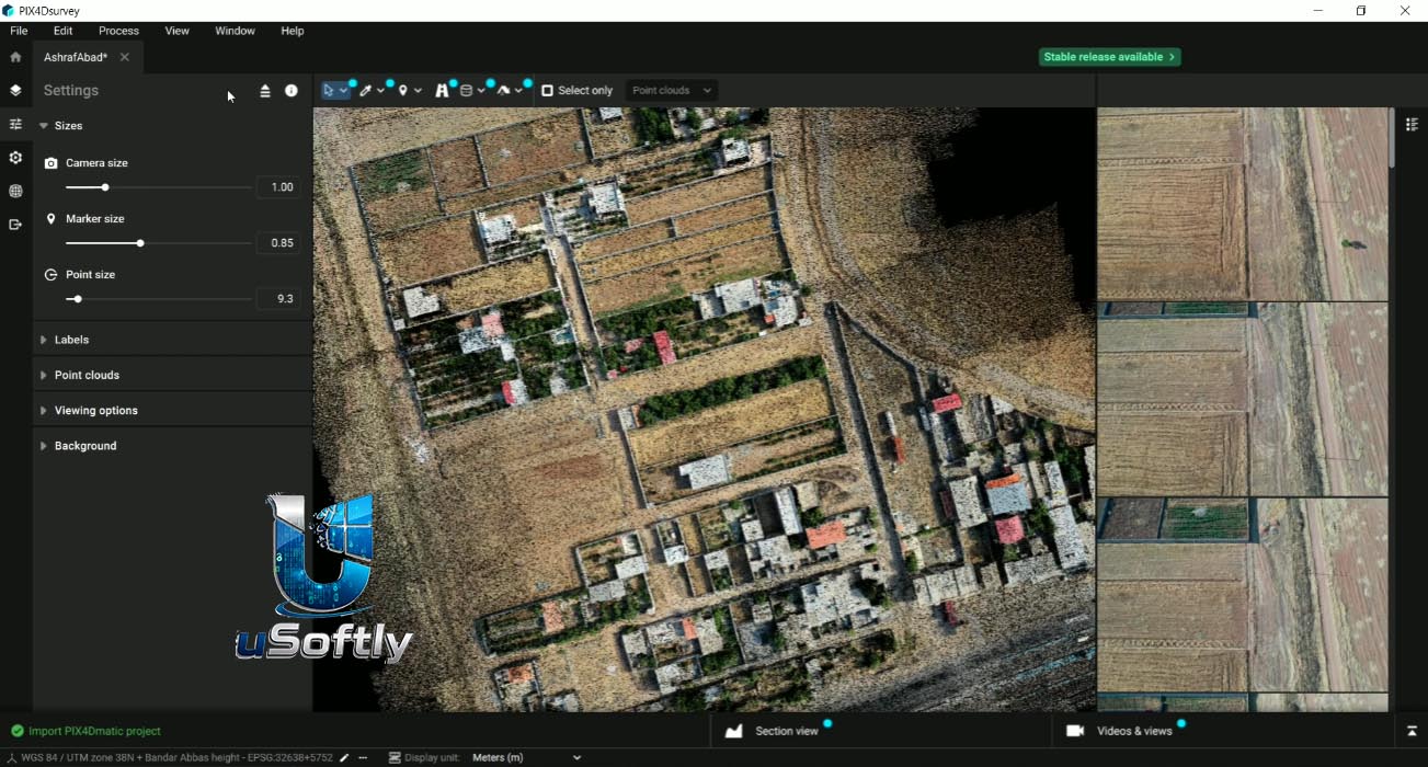
PIX4Dsurvey & PIX4Dmatic v1.83 – Unified Photogrammetry and Point Cloud Vectorization Workflow
PIX4Dsurvey and PIX4Dmatic are two complementary products from Pix4D that together cover the complete workflow from raw imagery to engineering-ready deliverables:
-
PIX4Dmatic is a large-scale photogrammetry processing engine that transforms thousands of aerial images into dense point clouds, orthomosaics, DSMs, and 3D meshes—maintaining survey-grade accuracy while processing massive datasets.
-
PIX4Dsurvey is a vectorization and CAD preparation tool that bridges photogrammetry and CAD by extracting points, polylines, polygons, catenaries, and surfaces from point cloud data—which can be imported from PIX4Dmatic, PIX4Dmapper, or any LAS/LAZ file.
Primary Users
PIX4Dsurvey and PIX4Dmatic are designed for surveyors, geospatial professionals, civil engineers, mapping specialists, and forensic investigators who require high-precision photogrammetry processing and CAD-ready vectorization from drone and LiDAR data. The consolidated platform serves professionals who:
-
Process large-scale aerial surveys from drones, manned aircraft, and terrestrial capture
-
Vectorize point cloud data (photogrammetric and LiDAR) into CAD-ready formats like DXF and SHP
-
Generate digital terrain models (DTM), orthomosaics, contour lines, and volume calculations
-
Combine multiple data sources including imagery, LiDAR, and laser scanner data in a single project
-
Produce forensic reconstructions and collision investigations using precise 3D models
Key Features & Capabilities
PIX4Dmatic (Processing Engine)
| Capability | Description |
|---|---|
| Large-Scale Processing | Process thousands of aerial or terrestrial images with survey-grade accuracy; supports datasets beyond 1.8 billion points |
| Point Cloud Generation | Dense, depth, or fused point clouds in .las/.laz/.xyz formats |
| Orthomosaic | Geometrically corrected and color-balanced orthomosaics with manual editing tools |
| DSM/DTM | Digital surface and terrain models with polygon-aware editing, flattening rooftops, and filling water/sparse areas |
| Terrain Classification | Machine-learning classification into ground, road, buildings, vegetation, and human-made objects |
| Contour Lines & TIN | Generate contour lines at defined intervals and triangulated irregular networks (TIN) for terrain modeling |
| 3D Mesh | Textured mesh outputs in .obj, .slpk, .fbx, Cesium 3D Tiles, and .laz |
| Gaussian Splatting (Pro) | Photorealistic 3D visualization; 30% faster processing and reduced VRAM in version 2.7.0 |
| Volume Calculations | Earthwork and material analysis using LandXML surfaces (available in PIX4Dsurvey, coming soon to PIX4Dmatic) |
| GPU Acceleration | Support for Intel Arc GPU hardware acceleration and multi-core CPU/GPU processing |
PIX4Dsurvey (Vectorization & CAD Workflow) – now integrated into PIX4Dmatic 2.X
| Capability | Description |
|---|---|
| Multi-Source Import | Import .p4d, .p4m, .las, .laz files; combine multiple point clouds in one project |
| Vectorization Tools | Extract points, polylines, polygons, circles (3-point method), arcs, and catenaries from point clouds and images |
| Terrain Filter | Classify point clouds into terrain and non-terrain points; generate DTM with Smart Grid, TIN, and contour lines |
| Smart Grid | Automates spot elevation creation—creates points only where terrain changes occur, saving thousands of manual clicks |
| Volume Measurement | Calculate stockpile and object volumes; import/export volume bases in .shp format |
| Geoid Support | Multiple geoid models including Svalbard_EGG2015, BONGEO2004, Japan JPGEO2024, Hungary Geoid2014, Greece GR_HEPOS2011 |
| Export Formats | CAD-ready .dxf, .shp, LandXML, GeoTIFF, and video exports |
What’s New in v1.83 [2025]
PIX4Dsurvey v1.83.0 (Preview, September 30, 2025) introduces several enhancements:
-
3-Point Circle Creation: New method for creating circles by defining three points on the circumference
-
Horizontal Projection Distortion Factor: Added to the information popup for “Distortion-aware measurements” setting
-
Welcome Page Enhancement: “Open project” option added to the project context menu
PIX4Dmatic v2.7.0 (Preview, June 22, 2026) brings significant updates:
-
DSM/DTM/Orthomosaic ROI Restriction: New button to cut outputs to current Region of Interest (ROI)—export small sections without reprocessing entire project
-
GPU Engine Upgrade: Replaced OpenGL with Direct3D (Windows) and Metal (macOS) for improved rendering performance; minor instabilities may occur and are being addressed
-
Gaussian Splatting Improvements (Pro): 30% faster processing, reduced VRAM footprint (now runs on GPUs with 10GB+ VRAM), and improved accuracy on flat surfaces
-
Faster GeoTIFF Export: Improved export times for local files and PIX4Dcloud uploads
-
DSM/DTM Visualization Modes: New Color map, Hillshading (Greyscale), and Combined modes with vertical exaggeration slider
PIX4Dmatic 2025 Highlights include:
-
Orthomosaic Editor: Manual fine-tuning to remove unwanted artifacts (moving objects) for clean final deliverables
-
LiDAR + Drone Data Fusion: Drag-and-drop LAS/LAZ files into any project; automatic CRS alignment and merging
-
LandXML Volume Calculations: Industry-standard surface comparison for earthwork and material analysis (in PIX4Dsurvey; coming to PIX4Dmatic soon)
-
Improved Vectorization: 2D vector drafting with polygons, 3-point arcs, circles, layer locking, and area properties for closed polylines
-
Boosted Data Exchange: FBX mesh export, KML, CSV, LandXML, and orthomosaic export without transparency






Reviews
There are no reviews yet.