Download PointCab 4 AutoCAD 3.0 – Specialized Point Cloud Processing Plugin for AutoCAD
PointCab 4 AutoCAD 3.0 is a specialized plug-in designed to enhance Autodesk’s AutoCAD software for advanced point cloud processing. Developed to address the challenges of handling large laser scan and photogrammetry datasets within a CAD environment, this tool is crucial for professionals in civil engineering, surveying, construction, architecture, and BIM coordination. It bridges the gap between raw 3D scanning data and actionable design information, making complex point cloud data more manageable and useful for everyday engineering tasks.
Overview of PointCab 4 AutoCAD and Its Role in Surveying and Construction
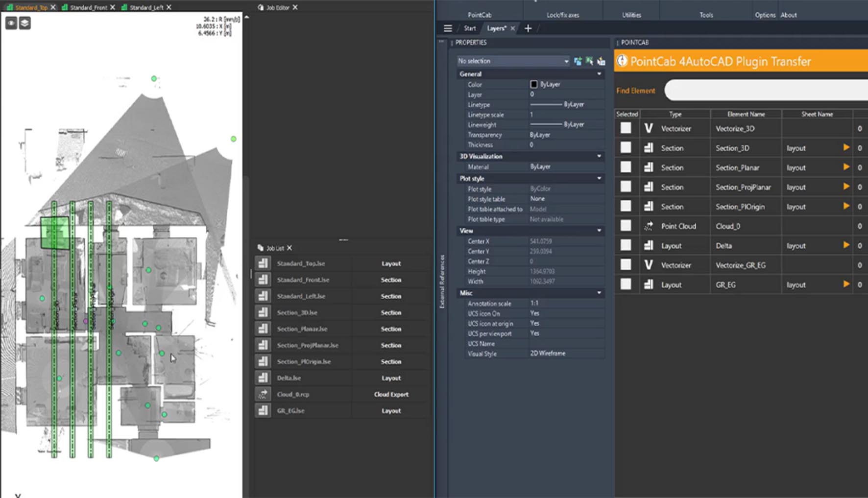
PointCab 4 AutoCAD functions as a powerful extension for AutoCAD, enabling users to effectively import, process, and analyze massive point cloud datasets. Its integration within the familiar AutoCAD interface streamlines workflows for creating precise as-built documentation, performing detailed site analysis, and ensuring construction accuracy. This software is particularly relevant for surveyors needing to convert raw scan data into accurate topographic maps, architects documenting existing structures for renovation or new design, and construction professionals verifying progress against design models.
Advanced Point Cloud Processing Capabilities Tailored for CAD Workflows
Intelligent Compression and Automatic Feature Extraction
The software leverages intelligent algorithms to compress large point cloud files, significantly reducing their size without compromising quality. This optimization is essential for maintaining performance within AutoCAD. PointCab 4 AutoCAD also features AI-driven automatic feature extraction, capable of detecting and segmenting common elements such as planes, cylinders, and spheres directly from the point cloud data.
Section and Cross-Section Generation for Precise Drafting
Users can directly generate section planes and cross-sections from point cloud data. This capability allows for the creation of precise 2D drawings and detailed profiles, which are fundamental for drafting and design within traditional CAD workflows. These generated sections can be directly used for measurements and further design modifications.
Seamless AutoCAD Integration for Enhanced Productivity
Native AutoCAD Object Conversion and Real-Time Visualization
A key feature of PointCab 4 AutoCAD is its ability to convert point cloud data into native AutoCAD objects, including lines, polylines, points, and blocks. This conversion process allows edited or created objects to behave as standard AutoCAD entities, greatly enhancing compatibility and usability. Real-time visualization tools ensure that users can review and interact with the point cloud data efficiently.
Coordinate System and Layer Management
The plug-in supports flexible coordinate system management, allowing seamless transformation of point cloud data. It also offers intelligent layer assignments for imported objects and processed data, ensuring that the resulting CAD elements are organized according to standard project layering conventions, thereby improving project management and collaboration.
Precision Measurement, Analysis, and Documentation Tools
Automated Dimensioning and Area/Volume Calculations
PointCab 4 AutoCAD automates critical measurement tasks directly from the point cloud. This includes the automatic extraction of dimensions, lengths, areas, and volumes without the need for manual tracing or complex setup. The software can calculate volumes for stockpiles or excavations and measure distances and heights with high precision.
Deviation Analysis and Reporting for Construction Verification
The software includes robust tools for deviation analysis, enabling comparison between captured as-built point cloud data and original design models (e.g., from BIM or CAD). This functionality is vital for construction verification, quality control, and identifying discrepancies, generating detailed reports that highlight areas of concern for project stakeholders.
Enhanced Workflow and Performance Features in Version 3.0
AI-Powered Feature Recognition and Smart Classification
Version 3.0 introduces more sophisticated AI capabilities for recognizing and classifying specific architectural and engineering elements within point clouds. This includes smart identification of pipes, structural elements, and other components, accelerating the process of creating intelligent BIM models or detailed CAD drawings.
GPU Acceleration and Multi-Core Optimization
Supporting NVIDIA CUDA technology, PointCab 4 AutoCAD 3.0 utilizes GPU acceleration for intensive point cloud processing tasks. Combined with multi-core CPU optimization, this significantly speeds up operations such as meshing, slicing, and feature extraction, allowing professionals to work with billions of points more fluidly and reducing computational wait times.
BIM 360 and Revit Interoperability for Collaborative Projects
The plug-in enhances interoperability with the Autodesk ecosystem, offering improved integration with BIM 360 and Revit. This ensures that processed point cloud data and derived BIM elements can be seamlessly shared and managed within collaborative cloud-based project environments, supporting integrated project delivery workflows.
Practical Applications and Case Examples in Surveying and Construction
Surveyors utilize PointCab 4 AutoCAD to process data from terrestrial laser scanners and mobile mapping systems, creating highly accurate digital terrain models, topographic surveys, and site plans. Architects leverage it for precise as-built surveys of existing buildings, facilitating renovations, extensions, and historical preservation projects by providing detailed 3D geometric information. In construction, it is invaluable for monitoring site progress, verifying installations against design specifications, and generating reports for quality assurance and clash detection, particularly when integrating drone-captured data for site-wide analysis.
Frequently Asked Questions
How does PointCab 4 AutoCAD improve processing large point cloud datasets in AutoCAD?
PointCab 4 AutoCAD uses advanced AI algorithms and GPU acceleration for intelligent point cloud compression and fast processing, allowing users to handle millions to billions of points efficiently within AutoCAD’s environment. This results in smoother visualization and faster workflow without losing data fidelity.
What industries commonly use PointCab 4 AutoCAD?
PointCab 4 AutoCAD is widely used in civil engineering, surveying, construction, architecture, facility management, and BIM coordination for processing laser scan or photogrammetry data to create accurate as-built models and support project verification.
Can PointCab 4 AutoCAD integrate with other BIM tools like Revit?
Yes, PointCab 4 AutoCAD offers BIM 360 integration and improved interoperability with Revit through shared coordinates, facilitating seamless workflows between point cloud data processing and BIM modeling environments.


Reviews
There are no reviews yet.