Download Rocscience RocTunnel3 – Advanced 3D Rock Stability Analysis for Underground Excavations
Rocscience RocTunnel3 is specialized 3D rock stability analysis software developed by Rocscience Inc. for engineers in civil and mining sectors. It is designed to evaluate the stability of underground excavations by analyzing block formations created by intersecting joints within 3D rock masses. This advanced tool is crucial for geotechnical engineers, tunnel engineers, and professionals involved in underground construction aiming to ensure safety and optimal design.
Advanced 3D Block Formation and Stability Analysis
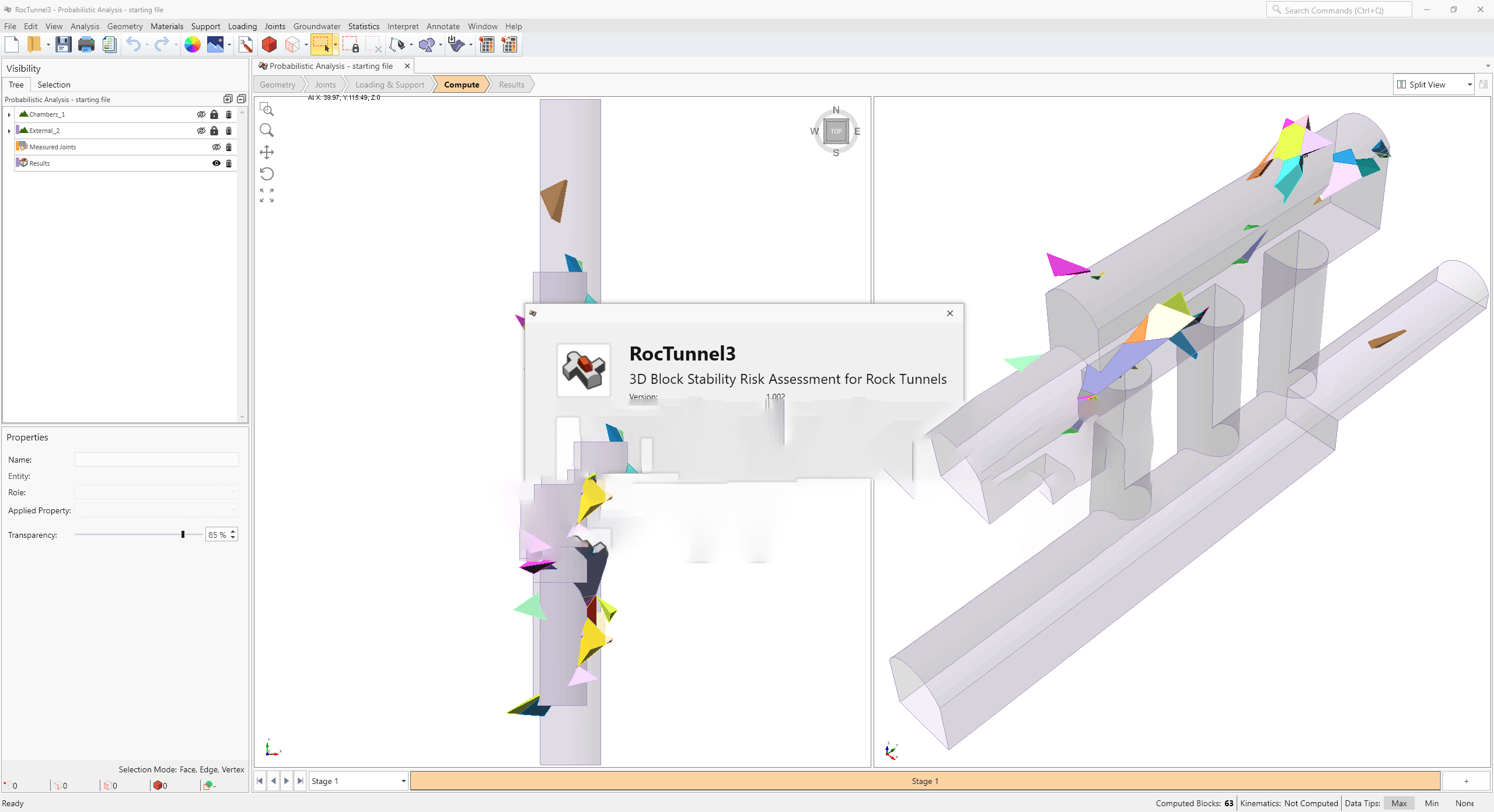
Rocscience RocTunnel3 excels at identifying and analyzing valid rock blocks formed by the intersection of multiple joint sets within complex 3D geological structures. It employs 3D limit equilibrium methods to calculate the factor of safety for these blocks, providing critical insights into potential failure mechanisms. The software supports both deterministic calculations, using specific input parameters, and probabilistic analyses, which account for variability in rock properties, joint characteristics, and excavation geometry to provide a range of potential safety factors.
Designing Support Systems for Staged Excavation Projects
The software facilitates sophisticated analysis of underground excavations through staged excavation modeling. This capability allows engineers to simulate the excavation process in sequential phases, assessing stability at each stage of construction. RocTunnel3 supports the design of essential ground support systems, including the application of shotcrete and rock bolts, and calculates required support pressures to meet stringent safety targets throughout the project lifecycle.
Modeling Complex Underground Geological Structures
RocTunnel3 is engineered to handle the complexities of real-world geological environments. It allows users to import detailed 3D geological models and joint data, creating an accurate representation of the underground conditions. Following analysis, the software can export information regarding excavation designs and identified block failure modes, enabling seamless integration with other project documentation and design software.
Integration within the Rocscience Geotechnical Software Suite
As part of the broader Rocscience geotechnical analysis software package, RocTunnel3 works in conjunction with other specialized tools. This integration allows for a comprehensive approach to geotechnical challenges, where findings and data from RocTunnel3 can inform or be informed by analyses performed in complementary applications, providing a holistic view of project stability and design.
Industry Applications and Use Cases in Civil and Mining Engineering
Rocscience RocTunnel3 is extensively applied in civil and mining engineering for the design and safety assessment of various underground projects. It is instrumental in ensuring the structural integrity of tunnels, caverns, and other subterranean excavations. Specific applications include analyzing stability in hard rock mines, assessing potential failures in urban tunnel projects, and designing support for large-scale underground infrastructure development where complex jointing patterns are present.
Frequently Asked Questions
How does Rocscience RocTunnel3 perform 3D block stability analysis?
RocTunnel3 identifies valid rock blocks formed by intersecting joint sets in three-dimensional space and calculates the factor of safety for each block using a 3D limit equilibrium approach. It supports both deterministic and probabilistic analyses by accounting for variable rock properties and joint strengths.
Can Rocscience RocTunnel3 help design support systems for tunnels?
Yes, RocTunnel3 can analyze block stability during different excavation stages and calculate the required support pressures and depths. It enables design of shotcrete, bolts, and other support methods to maintain structural integrity in underground projects.
What types of geological data does RocTunnel3 support for modeling?
The software allows importing detailed 3D geological and joint data for accurate underground excavation models. Users can update and export excavation geometries and block failure information for integration with other geotechnical workflows.


Reviews
There are no reviews yet.