
Download Exelis ENVI 5.3.1 – Advanced Remote Sensing Software
Exelis ENVI 5.3.1 is a powerful software application specifically designed for processing and analyzing geospatial imagery, making it an indispensable tool in the field of remote sensing. Developed by Exelis, now part of Harris Corporation, this software caters to professionals and researchers in environmental and Earth sciences, enabling advanced spatial analysis of satellite and aerial imagery. Its robust capabilities support a wide range of applications critical for scientific research and environmental management.
Overview of ENVI Software
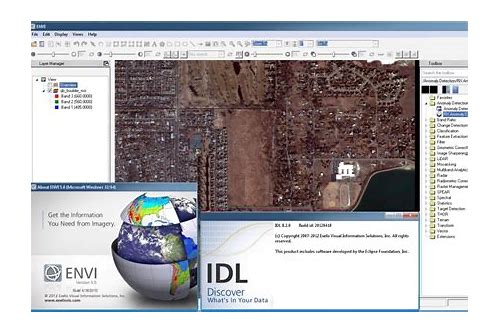
ENVI, which stands for Environment for Visualizing Images, is a comprehensive platform for image processing and analysis within the remote sensing domain. It provides users with the tools to interpret and extract valuable information from various geospatial data sources. The software has a history of supporting complex analytical workflows, building on its integration with IDL (Interactive Data Language) to offer a flexible environment for both standard and custom data manipulation.
Key Applications in Remote Sensing
The capabilities of Exelis ENVI 5.3.1 are leveraged across numerous sectors that rely on detailed analysis of Earth’s surface and atmosphere. Its application extends to monitoring critical environmental changes, supporting agricultural planning and management, and aiding in disaster response efforts.
- Environmental Monitoring: Analyzing land cover changes, tracking deforestation, and monitoring water quality and vegetation health.
- Agriculture: Assessing crop health, predicting yields, and optimizing irrigation strategies using spectral analysis from aerial and satellite platforms.
- Disaster Management: Rapidly analyzing imagery to assess damage from natural disasters such as floods, wildfires, and earthquakes for effective response and recovery planning.
- Urban Planning: Mapping urban sprawl, analyzing infrastructure development, and monitoring changes in land use within metropolitan areas.
- Geology and Mineral Exploration: Identifying geological formations and potential mineral deposits through hyperspectral and multispectral imagery analysis.
Core Features and Capabilities
Exelis ENVI 5.3.1 offers a sophisticated suite of tools for handling and interpreting geospatial imagery. Its functionality allows for in-depth data analysis, from basic image enhancement to complex scientific modeling.
- Metadata Extraction: Comprehensive capabilities for reading and interpreting metadata associated with various geospatial image formats.
- Advanced Data Analysis Techniques: Support for a wide array of algorithms including classification, spectral analysis, feature extraction, and change detection.
- Image Processing: Tools for image enhancement, correction, transformation, and mosaicking of raster data.
- Visualization Tools: Interactive 2D and 3D visualization capabilities for exploring geospatial datasets.
- Extensive Data Format Support: Compatibility with a broad range of raster data formats, including but not limited to GeoTIFF, HDF, NetCDF, and various proprietary satellite and aerial imagery formats.
- Integration with GIS: Seamless integration with Geographic Information Systems (GIS) for spatial data management and analysis workflows.
Enhancements in Version 5.3.1
While detailed specifics on version 5.3.1 require direct access to release notes, typical enhancements in ENVI versions focus on improving analytical accuracy, expanding data compatibility, and refining user interaction. These updates generally include new algorithms, performance optimizations, and improved integration with other software environments such as IDL.
Real-world Use Cases
ENVI has been instrumental in numerous significant research and operational projects globally. Its ability to process and analyze complex geospatial data has led to critical insights in environmental science and management.
- Land Use Classification Projects: Researchers have utilized ENVI for detailed land use mapping and classification, crucial for understanding landscape dynamics and for environmental compliance.
- Deforestation Tracking: The software has been applied to monitor forest cover changes over time, providing essential data for conservation efforts and climate change research.
- Urban Planning Initiatives: Urban planners have employed ENVI to analyze urban growth patterns, assess infrastructure needs, and manage urban expansion effectively, using aerial and satellite imagery.
- Scientific Research: Academic institutions worldwide use ENVI for diverse research, including climate studies, ecological modeling, and land surface characterization.
Integration with IDL for Custom Analysis
A key strength of Exelis ENVI is its deep integration with the IDL programming language. This synergy empowers users to move beyond the standard graphical interface for highly customized data processing and analysis tasks.
- Custom Module Development: Users can leverage IDL to develop unique analytical routines and tools tailored to specific research questions or project requirements.
- Automated Workflows: IDL scripting allows for the automation of repetitive tasks, significantly increasing efficiency for large-scale data processing.
- Advanced Visualization: IDL’s powerful visualization capabilities can be coupled with ENVI data for creating sophisticated graphical representations of analytical results.
- Extensibility: The integration essentially allows ENVI to be extended with any analytical or visualization capability that can be programmed in IDL, offering unparalleled flexibility for scientific analysis.
Conclusion and Getting Started with ENVI
Exelis ENVI 5.3.1 stands as a leading solution for geospatial imagery analysis, offering robust features for remote sensing professionals and researchers. Its powerful analytical tools, extensive data format support, and particularly its integration with IDL for custom solutions, make it a versatile platform for addressing complex environmental and scientific challenges. Users are encouraged to explore the software’s extensive documentation and community resources to fully harness its capabilities for their specific projects.
Frequently Asked Questions
What types of data can ENVI 5.3.1 analyze?
ENVI 5.3.1 is designed to analyze a wide array of geospatial data, which includes satellite imagery, aerial photographs, and various common raster data formats. Compatible formats include GeoTIFF, HDF, and NetCDF, ensuring flexibility for users working with diverse data sources in remote sensing and environmental studies.
How does ENVI integrate with the IDL programming language?
ENVI integrates seamlessly with IDL, enabling users to write custom functions and scripts. This integration allows for the development of specialized data analysis routines and advanced visualization techniques, thereby extending ENVI’s inherent capabilities to meet the unique demands of specific scientific projects and research objectives.
Can I use ENVI for environmental monitoring?
Yes, ENVI is extensively utilized for environmental monitoring applications. Its capabilities are well-suited for tasks such as land cover classification, change detection analysis, and detailed disaster response assessments, positioning it as a critical tool for environmental scientists and researchers engaged in understanding and managing our planet.


Reviews
There are no reviews yet.