PLEX EARTH 2026 FOR AutoCAD
PLEX Earth for Surveyors (AutoCAD Plugin) is a fully integrated surveying and COGO (Coordinate Geometry) solution that runs inside Autodesk AutoCAD (2023–2026). Unlike external survey software that requires tedious import/export steps, PLEX Earth provides surveyors with native CAD tools for point management, linework coding, traverse adjustment, legal description generation, contouring, and construction stakeout – all within the familiar AutoCAD environment. Version 2026 continues Plex Earth’s mission of bringing professional, field‑to‑finish surveying capabilities to the world’s most popular drafting platform. Whether processing raw GNSS/total station data, preparing ALTA surveys, or generating cut/fill maps for earthwork, this plugin delivers the precision, speed, and seamless CAD integration that modern survey professionals demand.
???? Primary Users
This professional surveying plugin for AutoCAD is designed for:
-
Land Surveyors & Geomatics Professionals performing coordinate geometry (COGO), traverse adjustments, and legal plat preparation entirely within AutoCAD.
-
Civil Engineers & Construction Surveyors drafting survey points, linework, contours, and stakeout data without leaving the CAD environment.
-
GIS & Mapping Specialists integrating field survey data with AutoCAD-based mapping and design workflows.
-
Mine Surveyors & Quantity Surveyors computing volumes, stockpiles, and excavation quantities from survey data.
-
Forensic & Legal Surveyors preparing ALTA/NSPS land title surveys and metes‑and‑bounds descriptions.
⚡ Key Features & Capabilities
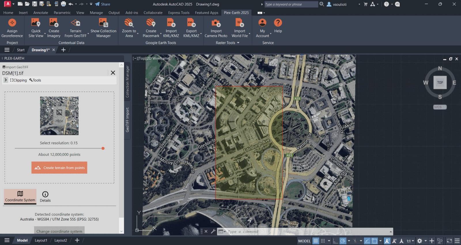
???? Survey Data Import & Point Management
Direct Import:
-
CSV, TXT, LandXML, DXF, DWG (points and linework)
-
Field controller formats: Trimble TSC3/TSC7, Leica CS, Topcon FC, Carlson, Spectra Precision
Point Management:
-
Point database (PNEZD + attributes)
-
Point labeling: number, elevation, description (fully customizable)
-
Point groups by code, layer, or elevation range
????️ Field-to-Finish COGO & Linework
Linework Coding:
-
Field code library (CLS = closed lot, EP = edge pavement, BLDG = building, etc.)
-
Automatic linework generation, layer assignment, symbology
COGO (Coordinate Geometry):
-
Bearing‑distance, angle‑distance, azimuth, intersection, curve layout
-
Traverse entry, closure report (precision, error)
-
Inverse, area by coordinates, parcel subdivision
???? Survey Adjustments & Computations
Traverse / Network Adjustment:
-
Least squares, compass rule, transit rule
-
Horizontal and vertical closure reports
Legal Descriptions & Plats:
-
Generate metes‑and‑bounds from linework
-
Curve calls (delta, radius, arc length, chord)
-
Plat annotation, lot & block tables
????️ Surfaces, Contours & Earthwork
-
TIN surface from points, breaklines, boundaries
-
Major/minor contours, user intervals, smoothing
-
Slope analysis, watershed delineation
-
Cut & fill volumes (grid, composite, prismoidal)
???? Construction Stakeout
-
Stakeout points, offset, slope staking from design surface
-
Export stakeout file: Trimble TTM, Topcon SZF, Leica JOB (optional)
????️ GIS & COGO Data Interoperability
-
Import/Export LandXML, Shapefile, KML/KMZ
-
Export to Topcon 3D‑MC2, Trimble SCS900, Leica iCON (site preparation)
???? What’s New in Version 2026
-
AutoCAD 2023–2026 Support – Full compatibility with all recent AutoCAD verticals (Civil 3D, Map 3D)
-
Legal Document Generator – ALTA/NSPS Table A checklist, metes‑and‑bounds MS Word export
-
Point Cloud Module – LAS/LAZ, E57, RCP import; contour & profile extraction
-
GNSS SNR+ Filter – Improved RTK/PPK point quality ranking
-
Field‑to‑Finish (F2F) Enhancements – Customizable code libraries, symbology, layer mapping
-
Real‑Time Weather – Atmospheric correction for GNSS base‑rover (met data)
???? System Requirements
Software Requirements
-
Host: Autodesk AutoCAD (2023, 2024, 2025, or 2026) – 64-bit version
-
OS: Windows 10/11 (64-bit)
-
RAM: 8 GB minimum (16 GB+ recommended)
-
Storage: 5 GB free space
-
Display: 1280 × 1024 resolution
???? Industry Applications
????️ Boundary & ALTA Surveys
-
Traverse from field control
-
Metes‑and‑bounds legal descriptions
-
Lot closure, area computation (acres, square feet)
-
ALTA/NSPS Table A items
????️ Construction Layout
-
Stakeout points from CAD design
-
Slope staking (cut/fill at offset)
-
Machine control model export
???? Topographic & Contour Mapping
-
Breakline & point import
-
TIN surface, contours (major/minor)
-
Export to civil design software (LandXML)
⛏️ Mining & Earthwork
-
Stockpile volume (grid / section)
-
Pit floor mapping, cross‑section extraction
???? As‑Built & Record Drawings
-
Record location of built elements (utilities, structures, paving)
-
GIS attribution for asset management


Reviews
There are no reviews yet.