
Download Agisoft Metashape Professional – Advanced Photogrammetry Software
Agisoft Metashape Professional is a sophisticated photogrammetry software developed by Agisoft LLC, designed to generate high-quality 3D spatial data from digital images. Evolving from its previous iteration, Agisoft PhotoScan, this professional version is particularly suited for GIS content creation, serving professionals in archaeology, GIS, the UAV industry, and 3D modeling. Its robust capabilities enable efficient and accurate 3D modeling for both controlled and uncontrolled environments, making it a vital tool for complex data processing and analysis.
Introduction to Agisoft Metashape
Overview and Historical Background
Agisoft Metashape Professional represents the advanced iteration of Agisoft’s photogrammetry solutions, building upon the foundation previously established by Agisoft PhotoScan. This evolution signifies a progression in its capabilities, focusing on delivering comprehensive tools for creating detailed 3D models and accurate spatial data. The software is engineered to process digital photographs, transforming them into detailed 3D reconstructions applicable across a wide spectrum of scientific and industrial fields. Its development history reflects a commitment to providing sophisticated yet accessible photogrammetry solutions.
Core Functionalities for 3D Modeling
Photogrammetric Processing and Workflow
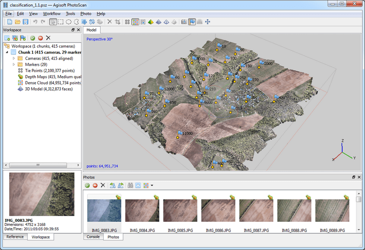
The core of Agisoft Metashape Professional lies in its powerful photogrammetric processing engine, which guides users through a structured workflow to create precise 3D models. This process begins with the alignment of input photographs, where the software automatically identifies common points and calculates camera positions and orientations. Following alignment, a dense point cloud is generated, representing the initial 3D structure of the surveyed scene. This point cloud is then converted into a textured 3D mesh, offering a detailed and visually realistic representation. Finally, orthomosaic generation and digital elevation model creation can be performed, providing georeferenced outputs essential for GIS and mapping applications.
Industry Applications and Use Cases
Key Industries Utilizing Metashape
Agisoft Metashape Professional is a versatile tool adopted across several demanding industries due to its precision and flexibility. In archaeology, it is instrumental for detailed documentation of excavation sites and artifacts, enabling precise 3D mapping and historical record-keeping. The GIS sector relies on Metashape for creating accurate aerial imagery, digital elevation models, and 3D topographic maps, supporting urban planning and land management workflows. Furthermore, the UAV industry utilizes Metashape extensively for aerial surveys, infrastructure inspection, and large-scale environmental monitoring, leveraging its efficiency in processing vast amounts of drone-captured imagery.
Advanced Features and Customization
Support for Various Image Types and Data Formats
Metashape Professional distinguishes itself with a comprehensive suite of advanced features designed for professional photogrammetry workflows. It supports a wide array of input data, including imagery from various camera types and formats, and allows for the integration of Ground Control Points (GCPs) to enhance model accuracy and georeferencing. The software includes robust tools for detailed mesh editing, texture manipulation, and generation of various data products like digital surface models (DSM) and digital terrain models (DTM). Advanced calibration methods ensure high precision, while support for extensive data formats facilitates integration with other geospatial software.
Integration and Automation Capabilities
Enhancing Workflows with Python Scripting
To maximize efficiency and handle large-scale projects, Agisoft Metashape Professional offers extensive integration and automation capabilities, primarily through Python scripting. This feature allows users to automate repetitive tasks, customize processing pipelines, and integrate Metashape’s functionalities into larger workflows. Batch processing capabilities enable the simultaneous processing of multiple datasets, significantly reducing the time required for complex projects, particularly those involving large volumes of data typical in UAV applications. This customizability makes Metashape a powerful platform for users requiring tailored photogrammetric solutions.
Comparative Analysis with Other Photogrammetry Tools
How Metashape Stands Out
Agisoft Metashape Professional differentiates itself in the competitive photogrammetry software market through a combination of powerful processing capabilities and extensive customization options. It provides a highly efficient workflow for image alignment and dense cloud generation, often outperforming other tools in speed and accuracy, especially in challenging environments. The integrated Python API is a key differentiator, offering unparalleled flexibility for automation and custom solution development that is often more accessible or advanced than in competing software. Furthermore, its strong focus on applications for archaeology and GIS provides specialized tools and outputs tailored to the needs of professionals in these fields.
User Guidance and Resources
Learning Resources and Community Support
Users of Agisoft Metashape Professional have access to a range of resources designed to support their learning and operational needs. The official Agisoft website provides comprehensive documentation, tutorials, and knowledge base articles covering various aspects of the software’s functionality. Active user forums and online communities offer a platform for users to share experiences, ask questions, and find solutions from peers and experts. These resources are invaluable for mastering the software’s advanced features, troubleshooting issues, and staying updated on best practices for photogrammetry and 3D modeling.
Frequently Asked Questions
What makes Agisoft Metashape different from other photogrammetry software?
Agisoft Metashape offers unique features such as fully automated image alignment and advanced editing capabilities, enabling more precise 3D modeling tailored for archaeology and GIS projects. It also supports a variety of image formats and extensive customization through scripting, providing a flexible and powerful solution for complex data processing needs.
Can I use Agisoft Metashape on different operating systems?
Yes, Agisoft Metashape is compatible with major operating systems including Microsoft Windows, macOS, and Linux, which provides flexibility for users across different platforms and existing IT infrastructures.
How does Agisoft Metashape handle large datasets from UAV projects?
Metashape is optimized for processing large datasets, especially from UAVs, featuring batch processing and automatic calibration tools that streamline the workflow for large image sets. Its efficient algorithms are designed to manage and process extensive aerial imagery effectively, ensuring timely delivery of results.


Reviews
There are no reviews yet.