
Download Avenza MAPublisher 11.3.2 – Advanced GIS Mapping Plugin for Adobe Illustrator
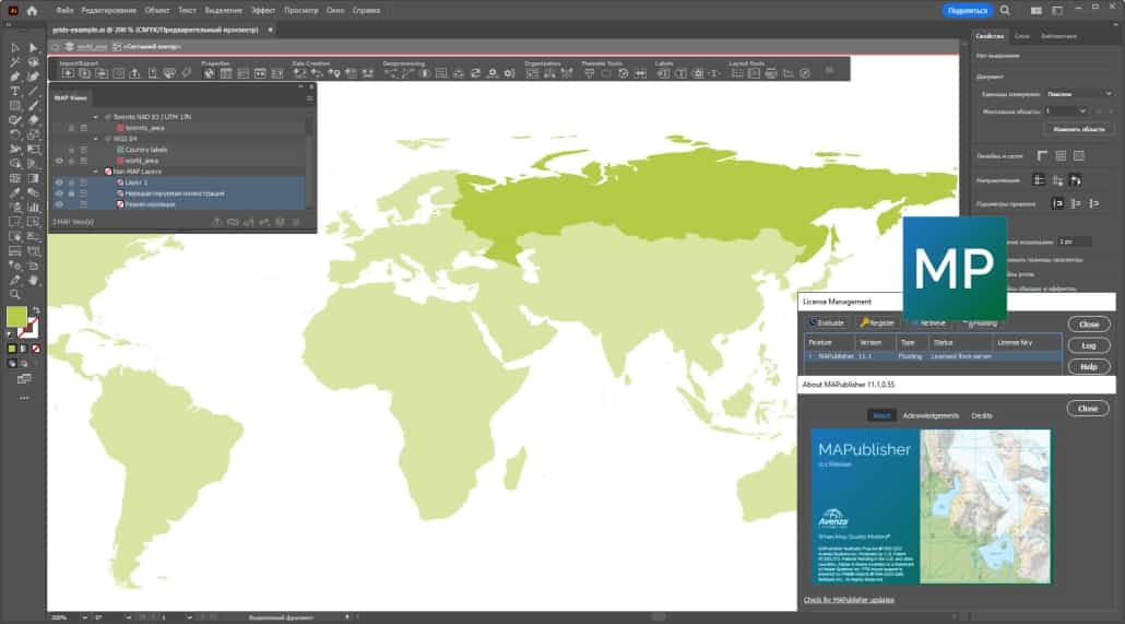
Avenza MAPublisher 11.3.2 is an advanced plugin for Adobe Illustrator, developed by Avenza Systems, designed to create sophisticated maps from Geographic Information System (GIS) data. This geospatial mapping software is crucial for professionals in fields such as environmental mapping, urban planning, and geographic information systems, enabling the transformation of raw data into high-quality cartographic products for print and digital distribution.
Introduction to Avenza MAPublisher
Overview of GIS Mapping Software
Avenza MAPublisher serves as a powerful extension within the Adobe Illustrator environment, empowering users to leverage complex GIS data for professional map creation. It bridges the gap between raw geospatial information and polished, publication-ready maps. By integrating seamlessly with Adobe Illustrator’s vector graphics capabilities, MAPublisher allows cartographers and designers to produce detailed and aesthetically refined maps essential for analysis, communication, and presentation in various scientific and planning disciplines.
Key Features and Capabilities
Enhanced Mapping Tools
Version 11.3.2 of Avenza MAPublisher introduces a suite of enhanced mapping tools designed to streamline the cartographic workflow and improve data handling. These advancements cater to the evolving needs of GIS professionals requiring precise control and efficient processing of geospatial information.
- Support for a broader range of GIS data formats, facilitating easier data import and integration.
- Advanced tools for map projection management, ensuring accurate geographic representation.
- Enhanced capabilities for georeferencing and spatial analysis directly within the Illustrator environment.
- Streamlined workflows for creating map layouts, grids, and labels with greater precision.
- New features may include improved tools for contour generation and data symbology options.
Applications in Environmental and Earth Sciences
The capabilities of Avenza MAPublisher make it an invaluable tool across numerous sectors within environmental and earth sciences. It facilitates the creation of detailed maps essential for understanding and communicating complex spatial information.
- Urban Planning: Used for developing zoning maps, land-use plans, and infrastructure visualization projects, aiding city planners in decision-making processes.
- Environmental Studies: Enables the creation of maps for environmental impact assessments, ecological surveys, and resource management plans, providing clear visual representations of environmental data.
- Spatial Analysis: Supports professionals in conducting detailed geospatial analysis by converting data into formats that allow for further interpretation and pattern identification.
- Geology and Geophysics: Facilitates the mapping of geological formations, seismic data, and resource deposits.
- Education: Provides educators and students with tools to create engaging and informative maps for learning purposes.
Integration with Adobe Illustrator
Avenza MAPublisher functions as a plugin, deeply integrating with Adobe Illustrator to provide a comprehensive cartographic solution. This integration combines Illustrator’s renowned graphic design strengths with MAPublisher’s specialized GIS functionalities, offering a unique advantage for map creation.
- Users can import various GIS data formats directly into Illustrator documents, maintaining their geographic integrity.
- MAPublisher tools operate within the familiar Illustrator interface, reducing the learning curve for existing Illustrator users.
- The plugin allows for extensive customization of map elements, leveraging Illustrator’s vector editing and graphic design features.
- Exporting maps in geospatial PDF format is supported, ensuring that the geographical data remains accessible and usable in other GIS applications.
Comparison with Other GIS Software
While numerous GIS software packages exist, Avenza MAPublisher offers a distinct approach by tightly integrating advanced GIS mapping functionalities with the powerful graphic design environment of Adobe Illustrator. This combination sets it apart from standalone GIS applications.
- Unlike many dedicated GIS platforms, MAPublisher excels in the final cartographic design and output stages, leveraging Illustrator’s superior typographical and layout capabilities.
- It provides a more intuitive workflow for designers and cartographers who are already proficient in Adobe Illustrator, avoiding the need to learn entirely new, complex GIS interfaces for map production.
- While other tools may focus purely on data analysis, MAPublisher enhances the visual communication of that analysis through high-quality map creation.
User Feedback and Real-world Use Cases
Professionals across various industries rely on Avenza MAPublisher for its robust features and seamless integration with Adobe Illustrator, employing it in diverse real-world projects to produce impactful cartographic outputs.
- City planning departments use MAPublisher to design public-facing maps illustrating proposed developments and zoning regulations, benefiting from the software’s ability to create clear, detailed graphics.
- Environmental consulting firms utilize MAPublisher to generate maps for environmental impact statements and conservation planning, translating complex survey data into understandable visual reports.
- Academic institutions and researchers employ the plugin for creating maps for publications and presentations, appreciating the combination of accurate geospatial data representation and professional graphic design possibilities.
- Transportation and logistics companies have used MAPublisher to create specialized route maps and network visualizations for operational planning.
Frequently Asked Questions
What is Avenza MAPublisher used for?
Avenza MAPublisher is a plugin for Adobe Illustrator that allows users to create high-quality maps from GIS data. It is primarily used in environmental sciences, urban planning, and geography for producing visually impactful maps for various applications, bridging the gap between raw geospatial information and polished cartographic products.
What are the benefits of using MAPublisher with Adobe Illustrator?
Using MAPublisher with Adobe Illustrator combines advanced mapping capabilities with a robust design platform, allowing for precise control over map aesthetics and functionality. It provides tools for importing and exporting multiple GIS data types seamlessly, offering a powerful solution for cartographers and designers familiar with the Illustrator environment.
Can I use MAPublisher for digital map creation?
Yes, MAPublisher supports the creation of maps for both print and digital formats, allowing users to distribute their work through various digital platforms and formats. Its ability to export to geospatial PDF ensures that maps can be shared and utilized effectively across different digital workflows.


Reviews
There are no reviews yet.