Download Permit 3.0 – Advanced Erosion Calculator for Piping Systems
Permit 3.0 is an advanced erosion calculator specifically engineered for the analysis of piping components within petroleum systems. Developed with an understanding of critical industry needs, this software helps engineers in the oil and gas sector to accurately assess and predict erosion, thereby enhancing system integrity and operational efficiency. Its adherence to established industry standards underscores its utility for professionals engaged in managing complex piping networks.
Introduction to Permit 3.0
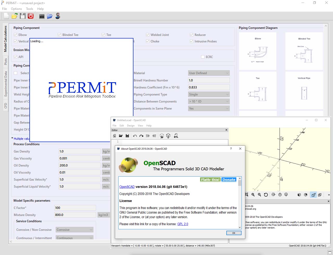
Permit 3.0 serves as a specialized tool within the Civil & Construction category, focusing on the construction and maintenance aspects of the oil and gas industry. It is designed to provide detailed erosion calculations for various piping components, a crucial factor in ensuring the longevity and safety of pipelines. The software aims to streamline the erosion analysis process, reducing the need for costly and time-intensive physical testing.
Core Functionalities and Its Capabilities
The core of Permit 3.0’s utility lies in its robust analytical capabilities. It enables engineers to perform comprehensive pipeline erosion analysis by processing specific input parameters. Key functions include:
- Accurate estimation of erosion rates in various piping geometries.
- Support for diverse models to cater to different operational conditions.
- Features facilitating efficient data processing and analysis for reduced turnaround times.
- Options for exporting analyzed data, supporting further integration into broader project management workflows.
Model Integration: API and DNV Standards
A significant strength of Permit 3.0 is its integration with recognized industry models. By incorporating standards developed by organizations such as the American Petroleum Institute (API) and Det Norske Veritas (DNV), the software ensures reliable and credible erosion predictions. This adherence to established benchmarks is vital for engineers working within stringent regulatory and safety frameworks inherent to the oil and gas sector.
Real-World Applications in the Oil & Gas Industry
In the oil and gas industry, Permit 3.0 is instrumental in maintaining the integrity of extensive piping networks. Professionals utilize its pipeline erosion analysis capabilities in scenarios such as:
- Assessing erosion risk in high-pressure fluid transport systems.
- Predicting wear on critical components like bends, elbows, and tees within refineries.
- Supporting maintenance scheduling by identifying areas prone to accelerated erosion.
- Enhancing the design phase of new pipeline projects by factoring in anticipated erosion.
These applications directly contribute to improved productivity and cost reduction by preventing unforeseen failures and optimizing material selection.
Data Visualization and Reporting Features
Permit 3.0 offers essential data visualization tools to aid in the interpretation of erosion analysis results. The software presents intricate data in a clear, graphical format, allowing for quicker comprehension of potential risks and system performance. Key reporting features include:
- Generation of plots and charts to illustrate erosion patterns over time or across different components.
- Exportable reports that can be integrated into official documentation and engineering assessments.
- Visual summaries that highlight critical areas requiring attention or further investigation.
Comparative Analysis with Similar Erosion Calculators
When compared to other erosion estimation tools, Permit 3.0 distinguishes itself through its dual-model support, leveraging both API and DNV standards for comprehensive analysis. This allows for a more versatile and thorough assessment of piping networks. Additionally, its user-friendly interface, coupled with specific features like alert notifications for input errors and data export capabilities, provides a streamlined user experience compared to more generic software solutions.
User Notifications and Input Management
To enhance user experience and data accuracy, Permit 3.0 includes robust input management and notification systems. The software actively checks user-provided data against recognized limits and standards, alerting the user to potential errors or inconsistencies. This feature helps maintain the integrity of the erosion calculations and prevents the propagation of mistakes, ensuring that the resulting analysis is both reliable and actionable for professionals in the field.
Frequently Asked Questions
What is Permit 3.0 and how does it work?
Permit 3.0 is an erosion calculator tool specifically designed for analyzing erosion in various piping components using established modeling standards such as those from API and DNV. It allows engineers to input parameters and receive detailed analyses on erosion estimates, helping to predict component wear and ensure pipeline integrity.
Which industries benefit the most from using Permit 3.0?
The primary users of Permit 3.0 are professionals in the oil and gas industry, as well as refineries and facilities dealing with liquid-gas operations, both onshore and offshore. Its specialized focus on piping erosion makes it particularly valuable for sectors where such systems are critical infrastructure.
How does Permit 3.0 compare to other erosion calculators?
Permit 3.0 is distinguished by its integration of both API and DNV standards, providing reliable predictions for erosion analysis. Its features like data visualization and user notifications set it apart from other available tools, offering a more comprehensive and user-friendly approach to pipeline integrity management.


Reviews
There are no reviews yet.