
Download Precisely MapInfo Pro 2023.2 – Advanced GIS Mapping Software
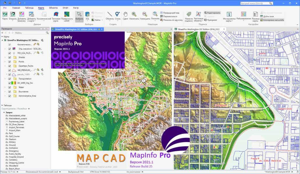
Precisely MapInfo Pro 2023.2 is a sophisticated geographic information system (GIS) software designed for advanced mapping and spatial analysis. Developed by Precisely, this application is crucial for professionals across various industries who require robust tools for visualizing, analyzing, and managing geographic data. Its comprehensive capabilities make it a powerful solution for complex GIS tasks.
Introduction to MapInfo Pro
Overview and Evolution
MapInfo Pro has a long-standing history in the Geographic Information Systems (GIS) field, evolving significantly since its inception. Originally developed by MapInfo Corporation and later acquired by Pitney Bowes, the software is now under the Precisely brand. This transition has seen continuous development, integrating new technologies and enhancing existing functionalities. Key versions have introduced advanced features such as improved graphics engines, expanded data support, and compatibility with modern web services, solidifying its position as a leading GIS solution.
Core Features and Capabilities
Thematic Mapping and Vector Analysis
MapInfo Pro offers robust capabilities for creating detailed thematic maps and performing sophisticated vector analysis. These tools enable users to derive meaningful insights from geographic data, enhancing decision-making processes.
- Thematic Mapping: Facilitates the creation of visually informative maps where geographic areas are colored or patterned to represent statistical data, such as population density, sales figures, or environmental conditions. This aids in understanding spatial patterns and variations.
- Vector Analysis: Provides advanced functionalities for manipulating and analyzing vector-based geographic data. This includes operations like buffering, overlay analysis, and network analysis, which are fundamental for detailed spatial problem-solving in fields like urban planning and environmental management.
Data Compatibility and Integration
Supported Formats and Systems
A key strength of Precisely MapInfo Pro lies in its extensive data compatibility and seamless integration with a wide array of external software and data sources, ensuring flexibility in data management workflows.
- Data Formats: The software supports a vast range of industry-standard data formats, including vector files like ESRI Shapefiles and AutoCAD DXF, tabular data such as CSV, and numerous raster formats including GeoTIFF and ERDAS IMAGINE.
- System Integration: MapInfo Pro is designed to integrate smoothly with other software systems, including databases, enterprise GIS platforms, and web mapping services. This interoperability allows for efficient data exchange and the incorporation of MapInfo Pro capabilities into broader enterprise workflows.
User Experience and Interface
Navigation and Ease of Use
Precisely MapInfo Pro is recognized for its user-friendly interface, which aims to simplify complex GIS operations for both novice and experienced users.
The intuitive layout and logical organization of tools within the interface help users navigate through various functions efficiently. Features such as customizable toolbars and clear visual cues assist in understanding spatial data and GIS concepts, lowering the learning curve associated with powerful geographic information system software.
Practical Applications across Industries
Case Studies and Use Cases
Precisely MapInfo Pro is instrumental in addressing real-world challenges across diverse sectors, enabling professionals to leverage spatial intelligence for informed decision-making.
- Urban Planning: Used for zoning analysis, land use management, infrastructure development planning, and visualizing demographic data to support community development initiatives.
- Environmental Management: Applied in environmental impact assessments, natural resource monitoring, pollution tracking, and identifying suitable locations for conservation efforts or infrastructure projects. The ability to analyze spatial data is crucial for understanding ecological systems.
- Logistics and Transportation: Utilized for optimizing delivery routes, managing fleet operations, site selection for distribution centers, and analyzing transportation networks for efficiency improvements.
- Marketing and Sales Analysis: Employed for territory design, customer segmentation based on geographic location, site analysis for retail locations, and understanding market penetration patterns.
Comparative Advantage over Competitors
Why Choose MapInfo Pro?
Precisely MapInfo Pro distinguishes itself in the competitive GIS software market through a combination of advanced functionality, ease of use, and robust integration capabilities.
- Advanced Analytical Tools: Offers sophisticated vector analysis and thematic mapping functions that provide deeper spatial insights compared to many general-purpose mapping tools.
- User-Centric Design: Features an intuitive interface that simplifies complex GIS operations, making powerful spatial data analysis accessible to a wider range of professionals.
- Broad Data and System Compatibility: Its extensive support for various data formats and seamless integration with external software and web services offer unparalleled flexibility for data management and workflow integration.
- Established GIS Heritage: Backed by years of development and user experience, MapInfo Pro provides a reliable and feature-rich platform for professional geographic information system needs.
Conclusion and Next Steps
Precisely MapInfo Pro 2023.2 stands as a comprehensive and powerful mapping software download for professionals engaged in spatial data analysis. Its blend of advanced GIS capabilities, user-friendly design, and extensive data compatibility makes it an indispensable tool for urban planning, environmental analysis, logistics, and marketing endeavors. By leveraging Precisely MapInfo Pro, organizations can unlock deeper insights from their geographic information and drive more effective, data-informed decisions.
Frequently Asked Questions
What is MapInfo Pro used for?
MapInfo Pro is a powerful geographic information system (GIS) software used for mapping and spatial analysis. It is ideal for urban planning, environmental analysis, logistics, and various other applications requiring visualization of spatial data, enabling professionals to interpret and utilize location-based information effectively.
What data formats does MapInfo Pro support?
MapInfo Pro supports a wide range of data formats including ESRI Shapefiles, AutoCAD DXF, CSV, and various raster formats like GeoTIFF. This versatility facilitates data integration from multiple sources, allowing users to work with the geographic information systems data they already possess.
How does MapInfo Pro differ from other GIS software?
MapInfo Pro differentiates itself with features like advanced vector analysis, thematic mapping capabilities, and robust compatibility with external systems, making it a preferable choice for professional GIS analysts seeking specialized tools for comprehensive spatial data analysis.


Reviews
There are no reviews yet.