
Download RadExPro – Comprehensive Seismic Data Processing Software
RadExPro is a specialized application designed for advanced geophysical data analysis, particularly focused on processing seismic data. Developed for professionals in environmental science, geology, and engineering, this software is instrumental in conducting subsurface studies and environmental assessments. Its robust capabilities make it a valuable tool for researchers and practitioners in the geophysics industry.
Overview of RadExPro
Introduction to the Software
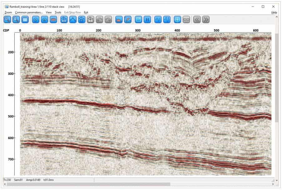
RadExPro stands out in the field of geophysics as a comprehensive solution for processing a wide array of seismic data. Its significance lies in its ability to handle both land and marine seismic acquisition techniques, providing detailed insights into subsurface structures. The software is essential for applications ranging from shallow environmental surveys to more complex geological explorations.
Main Processing Capabilities
Land Seismic Analysis
For land-based geophysical surveys, RadExPro 2020.2 offers specialized tools to analyze seismic reflection, refraction, and first-arrival travel-time tomography data. These functionalities enable users to delineate subsurface layers, identify geological structures, and assess material properties in terrestrial environments.
- Processing of seismic reflection data for detailed subsurface imaging.
- Analysis of seismic refraction for determining velocity structures and layer boundaries.
- First-arrival travel-time tomography for spatial velocity distribution mapping.
Marine Seismic Processing
RadExPro provides advanced algorithms crucial for marine seismic data processing. These tools are designed to overcome specific challenges encountered in offshore surveys, enhancing the clarity and reliability of the collected data.
- Demultiple techniques to suppress unwanted multiple reflections that obscure primary signals.
- Dechosting capabilities to correct for directional artifacts in towed streamer data.
- Debubbling algorithms to mitigate noise caused by air bubbles in marine seismic sources.
- High-resolution processing that improves imaging of subtle geological features in marine environments.
User Interface and Usability
RadExPro features a flexible and intuitive user interface, aiming to streamline the complex workflows involved in geophysical data analysis. This design philosophy facilitates a more efficient processing experience, reducing the learning curve for new users while maintaining the depth of control required by experienced professionals.
Applications in Various Industries
The versatile capabilities of RadExPro 2020.2 make it applicable across several key sectors. Its adaptive nature allows it to support a broad spectrum of geophysical investigations, from detailed environmental impact assessments to fundamental geological research.
- Environmental Studies: Analyzing near-surface geophysics for site characterization, groundwater mapping, and contamination monitoring.
- Engineering Projects: Conducting shallow seismic surveys for infrastructure development, geotechnical investigations, and hazard assessments.
- Academic Research: Supporting geological explorations, seismological studies, and the development of new geophysical methodologies.
- Resource Exploration: Assisting in the identification of potential subsurface resources through advanced seismic imaging.
Unique Features of RadExPro
RadExPro distinguishes itself through a combination of advanced processing algorithms and broad applicability. Its ability to handle diverse seismic methods and challenging data types provides a competitive edge in geophysical data analysis software.
- Comprehensive processing workflows for multiple seismic methods, including reflection, refraction, and tomography.
- Specialized algorithms for effective marine seismic data enhancement, such as demultiple and deghosting.
- Adaptability for processing both land and marine seismic data acquired through various acquisition systems.
- A user-centric interface designed to balance power and accessibility for a wide range of users.
Final Thoughts
RadExPro offers a powerful and comprehensive suite of tools for professionals engaged in seismic data processing. Its extensive features for both land and marine environments, coupled with an intuitive interface, make it a valuable asset for geophysical data analysis across environmental, engineering, and research applications. Exploring its capabilities can significantly enhance the precision and efficiency of subsurface investigations.
Frequently Asked Questions
What are the main features of RadExPro?
RadExPro offers comprehensive processing solutions for seismic reflection, refraction, and tomography methods, along with advanced algorithms for marine data processing like demultiple and debubbling. It caters to both land and marine seismic analysis, providing a broad range of tools for geophysical investigations.
How does RadExPro assist in marine seismic applications?
RadExPro enhances marine seismic applications through its high-resolution processing tools, including techniques for removing multiple reflections, deghosting, and bubble noise reduction, improving the quality of seismic data for clearer subsurface imaging.
Is RadExPro easy to learn for new users?
Yes, RadExPro is designed with a flexible user interface that simplifies the learning process, making it accessible for both experienced professionals and newcomers to geophysical data processing.


Reviews
There are no reviews yet.