
Download ZondSP 2D 5.0 – Advanced Software for Self-Potential Data Interpretation
ZondSP 2D 5.0, developed by Zond Software, is a specialized application designed for the interpretation of self-potential (SP) geophysical data. This software is instrumental for professionals in geophysical exploration and environmental studies, providing advanced tools to analyze subsurface characteristics. By focusing on the unique challenges of SP data, ZondSP 2D enables more accurate geological modeling and assessment.
Introduction to ZondSP 2D
Overview and Purpose
ZondSP 2D is a robust tool dedicated to the interpretation of self-potential (SP) data, which are crucial for understanding natural electric fields emanating from subsurface geological structures. The software facilitates the identification of anomalies that can indicate mineral deposits, groundwater flows, or geological faults. Its primary purpose is to convert raw SP measurements into actionable geological models, supporting a wide range of exploration and environmental monitoring tasks.
Applications in Geophysics
Industry Use Cases
The applications of ZondSP 2D span several critical areas within geophysics and environmental science. The software aids geophysicists and environmental engineers in tasks that require detailed subsurface investigation without direct physical intervention.
- Mineral Exploration: Identifying potential ore bodies by detecting SP anomalies associated with sulfide mineralization.
- Groundwater Studies: Mapping subsurface water pathways and identifying potential sources or flow directions.
- Geological Hazard Assessment: Investigating geological structures that may pose risks, such as areas prone to landslides or seismic activity.
- Environmental Monitoring: Assessing the subsurface impact of industrial activities or identifying seepages.
Key Features and Capabilities
Advanced Inversion Algorithms
ZondSP 2D incorporates sophisticated inversion algorithms that are central to its data interpretation capabilities. These methods allow for the estimation of subsurface properties based on observed SP data, moving beyond simple anomaly detection to detailed modeling.
- Probability Inversion: Leverages statistical approaches to provide a range of possible subsurface models, indicating uncertainty.
- Occam Inversion: Utilizes principles to find the smoothest possible model that fits the observed data, yielding a generally accepted solution.
- Parametric Inversion: Allows users to define specific geological structures or parameters to target within the inversion process.
Data Visualization Tools
Effective visualization is key to understanding complex geophysical data. ZondSP 2D provides comprehensive tools to present SP data and inversion results in an easily interpretable format.
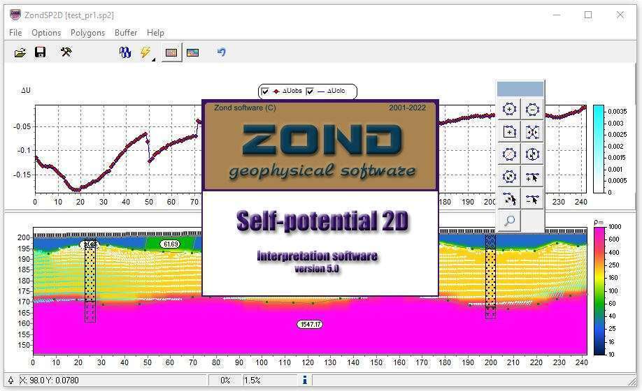
- 2D Cross-Sections: Visualizes subsurface data along specific profiles, showing variations in anomalous sources.
- 3D Representations: Enables the creation of three-dimensional models of the subsurface, offering a more complete spatial understanding of geological features.
- Data Plotting and Grids: Supports various plotting formats for raw data, processed anomalies, and inversion outputs, allowing for detailed analysis.
Integration with Other Zond Software
ZondSP 2D is designed to be part of a cohesive software ecosystem, enhancing workflow efficiency for geoscientists. Its compatibility with other Zond applications, particularly ZondRes2D, streamlines the analysis of multiple geophysical datasets.
The software seamlessly integrates with ZondRes2D, a tool for resistivity data interpretation. This allows users to combine SP and electrical resistivity data for a more comprehensive subsurface investigation, providing cross-validation and detailed insights into geological environments. The ability to import resistivity models enhances the overall accuracy and reliability of interpreting complex geological scenarios.
Mathematical Modeling and Data Management
The software’s mathematical modeling capabilities are integral to its self-potential data interpretation functionality. It supports various current sources and arrays, allowing for flexible data acquisition parameters to be considered during analysis.
ZondSP 2D handles diverse data formats essential for geophysical analysis. Users can effectively manage their datasets, preparing them for advanced processing and inversion. The tool’s focus on efficient data handling ensures that complex geological modeling can be performed with greater precision and speed, supporting a rigorous scientific approach to interpreting subsurface phenomena.
Real-world Applications and Success Stories
While specific project details may vary, ZondSP 2D has been applied in numerous geophysical exploration and environmental assessment projects requiring detailed SP data analysis. Its advanced inversion and visualization features contribute to successful outcomes in challenging environments.
Professionals utilize ZondSP 2D to investigate areas with potential for mineral resources, map underground water systems, and assess environmental impacts. The software’s capacity to model subsurface structures accurately helps in making informed decisions in geological mapping and resource management, demonstrating its value in practical geophysical problem-solving.
Frequently Asked Questions
What is ZondSP 2D used for?
ZondSP 2D is specialized software for interpreting self-potential data, commonly utilized in geophysical explorations to assess subsurface conditions related to natural electric fields. It helps identify anomalies indicative of various geological features, such as mineral deposits or groundwater flow.
How does ZondSP 2D handle data visualization?
ZondSP 2D offers robust visualization tools, enabling users to create 2D and 3D representations of geophysical data, enhancing the interpretation of complex geological scenarios. This allows for a deeper understanding of subsurface structures and anomalies.
Is ZondSP 2D compatible with other geophysical software?
Yes, ZondSP 2D is fully integrated with ZondRes2D and supports importing resistivity models, facilitating seamless collaboration across different software applications in geological studies. This compatibility enhances workflow efficiency and allows for integrated analysis of multiple geophysical datasets.


Reviews
There are no reviews yet.