
Download Golden Software Voxler 4.6.913 – Advanced 3D Geological Visualization Software
Golden Software Voxler 4.6.913 is an advanced visualization software developed by Golden Software LLC, specializing in the interpretation of geological and volumetric data in three dimensions. Tailored for professionals in the geological sciences, environmental science, and GIS sectors, Voxler facilitates complex data analysis and visual interpretation, significantly enhancing decision-making processes in earth science applications.
Understanding Voxler: Introduction and Key Applications
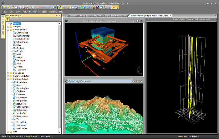
Golden Software Voxler is a powerful tool designed for high-fidelity 3D visualization of scientific data. Its primary function is to enable users to represent and analyze complex datasets, such as geological strata and volumetric measurements, in an interactive three-dimensional environment. This capability is crucial for geological surveys, environmental impact assessments, and resource management projects, allowing for a deeper understanding of spatial relationships and subsurface characteristics. The software supports professionals in making more informed decisions by providing clear visual representations of critical data.
Visualization Capabilities: 3D Modeling Features
Voxler offers a robust suite of tools for creating and manipulating 3D models from diverse data sources. Users benefit from high-speed processing that allows for the rendering of complex datasets in real-time, supporting the creation of interactive and dynamic visualizations. These features are essential for exploring subsurface geology, visualizing contaminant plumes in environmental modeling, and understanding the spatial distribution of resources.
- Creation of 3D surfaces, contours, and isosurfaces from gridded or scattered data.
- Rendering of point cloud data to represent raw survey information or detailed site models.
- Interactive manipulation of 3D scenes, including rotation, zooming, and panning, to facilitate detailed inspection.
- Generation of cross-sections and slicing planes to examine internal data structures.
Data Integration and Compatibility
A key strength of Golden Software Voxler is its extensive data compatibility, allowing users to integrate data from a wide array of sources into a unified 3D environment. This feature is vital for comprehensive geospatial analysis and ensures that diverse datasets can be leveraged effectively without extensive data transformation. The software supports efficient import and export routines, streamlining workflows for professionals working with multiple data types.
- Support for numerous geological and volumetric data formats, including ASCII text files, CSV, Surfer grids, and LAS files.
- Compatibility with raster and image files for overlaying spatial data onto geological models.
- Ability to import data from GIS software, enhancing interoperability within established geospatial workflows.
- Efficient export options for visualizations to various image and video formats for reporting and presentations.
User Interface and Experience
Voxler is designed with an intuitive user interface, which significantly simplifies the process of data interpretation and visualization, even for users with complex data requirements. The accessible layout and straightforward toolset allow professionals to focus on analyzing their data rather than navigating complicated software menus. This user-friendly approach enhances accessibility and productivity for a range of technical users in earth sciences and related fields.
Practical Use Cases in Environmental and Earth Sciences
The versatility of Golden Software Voxler makes it invaluable across various practical applications within the environmental and earth sciences. Professionals utilize its advanced visualization capabilities to gain critical insights, leading to improved outcomes in project execution and environmental stewardship.
- Geological Surveys: Visualizing subsurface geology, fault lines, and mineral deposit models to aid exploration and resource assessment.
- Environmental Impact Assessments: Modeling and visualizing the potential spread of contaminants in soil and groundwater, or mapping areas affected by pollution.
- Resource Management: Analyzing and representing the spatial distribution of natural resources, such as oil, gas, or water reservoirs.
- Site Characterization: Creating detailed 3D models of geological sites for construction, mining, or remediation planning.
Comparison with Other GIS Solutions
While many GIS software options exist, Golden Software Voxler distinguishes itself through its specialized focus on high-fidelity 3D visualization of geological and volumetric data. Its rendering speed and the intuitive creation of complex 3D scenes often surpass general-purpose GIS tools. Voxler’s capacity to seamlessly integrate diverse data formats into a coherent 3D model, combined with its user-friendly interface for geological interpretation, provides a distinct advantage for professionals concentrating on subsurface analysis and environmental modeling.
Conclusion
Golden Software Voxler 4.6.913 stands as a leading solution for advanced 3D geological modeling and data visualization. Its powerful visualization capabilities, broad data compatibility, and intuitive interface empower professionals in geological sciences and environmental fields to interpret complex data more effectively. By facilitating a clearer understanding of spatial relationships and subsurface structures, Voxler plays a critical role in informed decision-making for a wide range of earth science applications.
Frequently Asked Questions
What types of data can be visualized using Golden Software Voxler?
Voxler allows users to visualize a variety of data types, including geological, volumetric, and point cloud data in 3D formats. This flexibility makes it suitable for multiple applications in the earth sciences, enabling comprehensive analysis of diverse datasets.
How does Voxler compare to other GIS software options?
Voxler distinguishes itself from other GIS software through its advanced 3D modeling capabilities and user-friendly interface, designed specifically for geological data visualization. It offers seamless data integration and high-speed processing, setting it apart in the market for specialized earth science applications.
Can Voxler handle real-time data visualization?
Yes, Voxler supports interactive data manipulation, enabling users to filter and adjust datasets to draw immediate insights, which is crucial for timely decision-making in geological assessments and environmental monitoring.


Reviews
There are no reviews yet.